Hawkesbury night lights from space
Night Light of Hawkesbury (Ontario) from space (Canada) Src. Average luminocity for 10x10km area is 15.3985% and for 50x50km: 2.2756%.
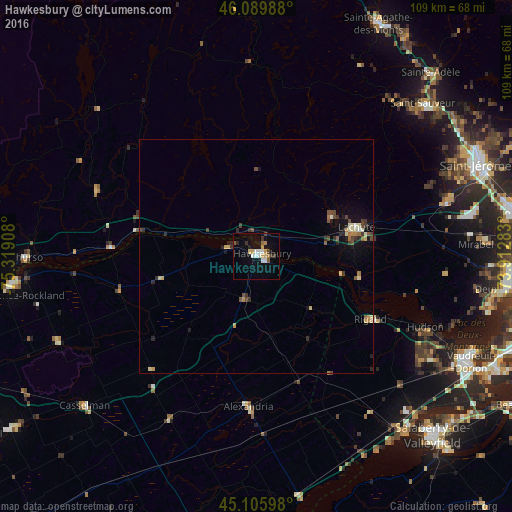
Analysis of Hawkesbury night lights 2016
Square area 10x10 km:
 2.12%
2.12%90-99
2.73%80-89
2.27%70-79
1.21%60-69
1.67%50-59
1.52%40-49
1.36%30-39
1.67%20-29
2.42%10-19
5.76%0-9
77.27%Square area 50x50 km:
0.1%90-99
0.33%80-89
0.4%70-79
0.17%60-69
0.28%50-59
0.29%40-49
0.49%30-39
0.41%20-29
0.49%10-19
1.11%0-9
95.92%Clear (daylight) street map image can be seen on geolist.org.
Map coordinates:
46° 5' 23.6" North, 75° 19' 8.7" West
45° 36' 0.3" North, 74° 36' 57.4" West
45° 6' 21.5" North, 73° 54' 46.2" West
Some cities around Hawkesbury sort by population:
• Mirabel
41.9 km =26 mi,  82°
82°
• Les Coteaux
46.2 km =28.7 mi,  139°
139°
• Saint-Lazare
43.7 km =27.2 mi,  120°
120°
• Saint-Canut
43.3 km =26.9 mi,  72°
72°
• Lachute
22.7 km =14.1 mi, 75°
• Saint-Sauveur
46.5 km =28.9 mi,  46°
46°
• Brownsburg-Chatham
18.1 km =11.2 mi,  59°
59°
• Hudson
40 km =24.9 mi,  114°
114°
5972360 (p: 12,283)
Sources (retrieved 2019-11-25):
» Earth at Night: Flat Maps 2012, 2016