Hamilton night lights from space
Night Light of Hamilton (Ontario) from space (Canada) Src. Average luminocity for 10x10km area is 90.0258% and for 50x50km: 24.5621%.
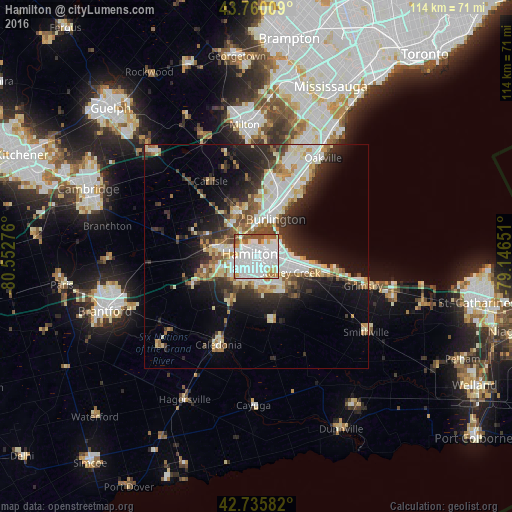
Analysis of Hamilton night lights 2016
Square area 10x10 km:
 52.58%
90-99
21.06%80-89
4.09%70-79
6.21%60-69
5.76%50-59
5.45%40-49
4.85%30-39
0%20-29
0%10-19
0%0-9
0%Square area 50x50 km:
5.69%90-99
5.56%80-89
2.9%70-79
2.18%60-69
2.48%50-59
2.58%40-49
2.48%30-39
3.68%20-29
6.37%10-19
10.12%0-9
55.97%Clear (daylight) street map image can be seen on geolist.org.
Map coordinates:
43° 45' 36.3" North, 80° 33' 9.9" West
43° 15' 0.4" North, 79° 50' 58.7" West
42° 44' 9" North, 79° 8' 47.4" West
Some cities around Hamilton sort by population:
• Mississauga
39.7 km =24.7 mi,  22°
22°
• Oakville
26 km =16.2 mi,  31°
31°
• Burlington
15.2 km =9.4 mi,  3°
3°
• Cambridge
39.4 km =24.5 mi,  288°
288°
• Milton
29.8 km =18.5 mi,  354°
354°
• Brantford
36.2 km =22.5 mi,  248°
248°
• Ancaster
11.7 km =7.3 mi, 252°
• Binbrook
14.7 km =9.1 mi,  167°
167°
5969782 (p: 519,949)
Sources (retrieved 2019-11-25):
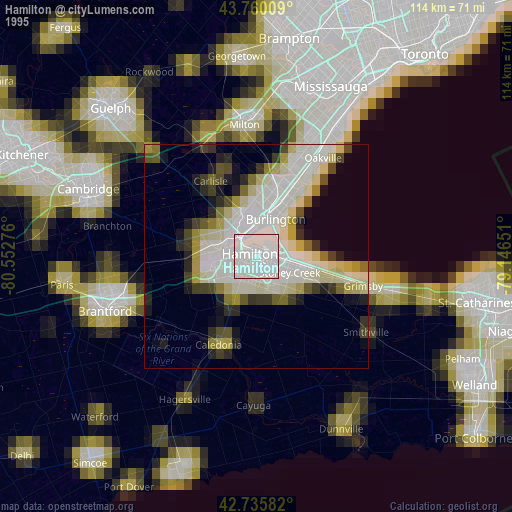
» NASA, Earths city lights 1995
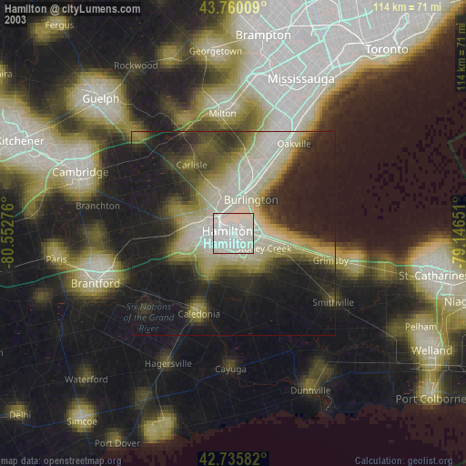
» NASA city lights 2003
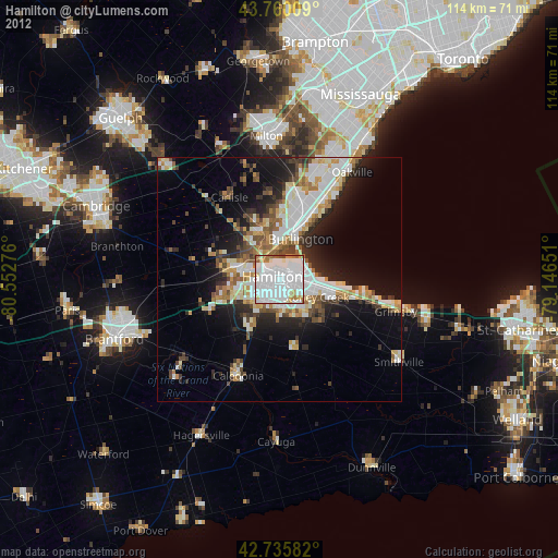
» Earth at Night: Flat Maps 2012, 2016