Burlington night lights from space
Night Light of Burlington (Ontario) from space (Canada) Src. Average luminocity for 10x10km area is 60.6% and for 50x50km: 37.1459%.
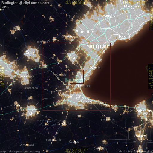
Analysis of Burlington night lights 2016
Square area 10x10 km:
 16.98%
90-99
18.57%80-89
6.51%70-79
4.6%60-69
4.29%50-59
6.98%40-49
4.13%30-39
7.62%20-29
15.4%10-19
12.38%0-9
2.54%Square area 50x50 km:
9.69%90-99
9.69%80-89
4.16%70-79
3.08%60-69
3.61%50-59
3.74%40-49
4.17%30-39
5.09%20-29
7.81%10-19
10.8%0-9
38.17%Clear (daylight) street map image can be seen on geolist.org.
Map coordinates:
43° 53' 42.1" North, 80° 32' 24.9" West
43° 23' 10.4" North, 79° 50' 13.7" West
42° 52' 23.1" North, 79° 8' 2.4" West
Some cities around Burlington sort by population:
• Mississauga
25.8 km =16 mi,  33°
33°
• Hamilton
15.2 km =9.4 mi,  183°
183°
• Brampton
33.5 km =20.8 mi,  9°
9°
• Etobicoke
36.9 km =22.9 mi,  36°
36°
• Oakville
14.3 km =8.9 mi,  60°
60°
• Milton
15 km =9.3 mi,  345°
345°
• Ancaster
22.3 km =13.9 mi,  212°
212°
• Binbrook
29.5 km =18.3 mi, 175°
5911592 (p: 164,415)
Sources (retrieved 2019-11-25):
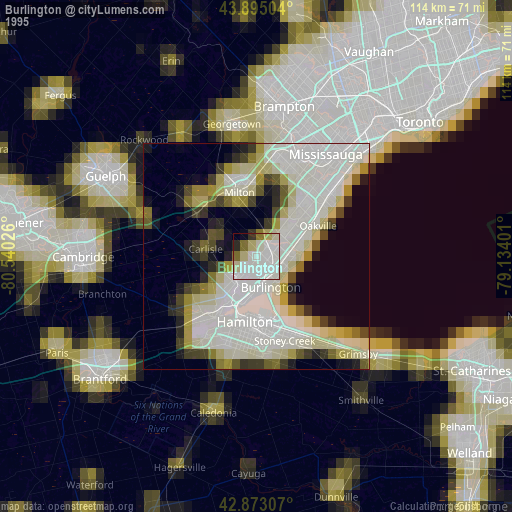
» NASA, Earths city lights 1995
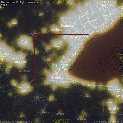
» NASA city lights 2003
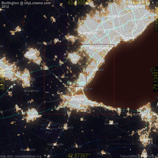
» Earth at Night: Flat Maps 2012, 2016