Oakville night lights from space
Night Light of Oakville (Ontario) from space (Canada) Src. Average luminocity for 10x10km area is 70.9063% and for 50x50km: 41.2636%.
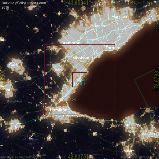
Analysis of Oakville night lights 2016
Square area 10x10 km:
 21.59%
90-99
26.19%80-89
9.37%70-79
6.35%60-69
5.08%50-59
2.38%40-49
2.38%30-39
4.6%20-29
11.11%10-19
7.62%0-9
3.33%Square area 50x50 km:
13.99%90-99
11.77%80-89
3.6%70-79
2.71%60-69
3.16%50-59
3.55%40-49
4.09%30-39
4.28%20-29
7.22%10-19
8.49%0-9
37.14%Clear (daylight) street map image can be seen on geolist.org.
Map coordinates:
43° 57' 30.3" North, 80° 23' 9.8" West
43° 27' 0.4" North, 79° 40' 58.5" West
42° 56' 15" North, 78° 58' 47.3" West
Some cities around Oakville sort by population:
• Toronto
35.1 km =21.8 mi,  37°
37°
• Mississauga
14.5 km =9 mi,  7°
7°
• Hamilton
26 km =16.2 mi,  211°
211°
• Brampton
26.8 km =16.7 mi,  345°
345°
• Etobicoke
24.5 km =15.2 mi,  22°
22°
• Burlington
14.3 km =8.9 mi,  240°
240°
• Milton
17.8 km =11.1 mi,  294°
294°
• Ancaster
35.7 km =22.2 mi,  223°
223°
6092122 (p: 165,697)
Sources (retrieved 2019-11-25):
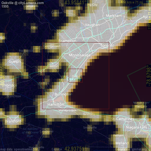
» NASA, Earths city lights 1995
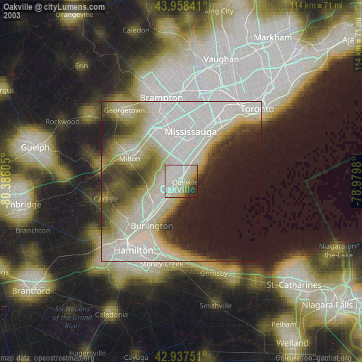
» NASA city lights 2003
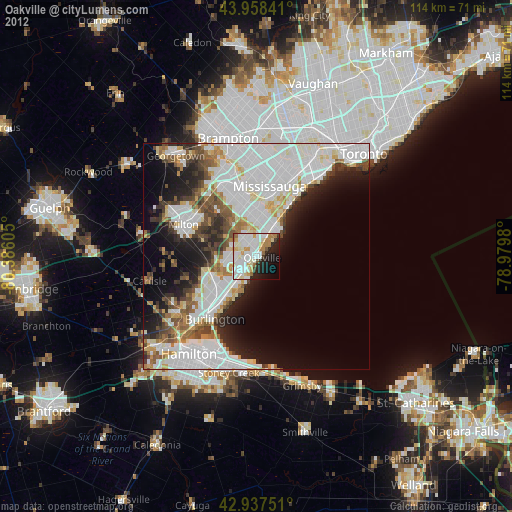
» Earth at Night: Flat Maps 2012, 2016