Halifax night lights from space
Night Light of Halifax (Nova Scotia) from space (Canada) Src. Average luminocity for 10x10km area is 73.8409% and for 50x50km: 11.6563%.
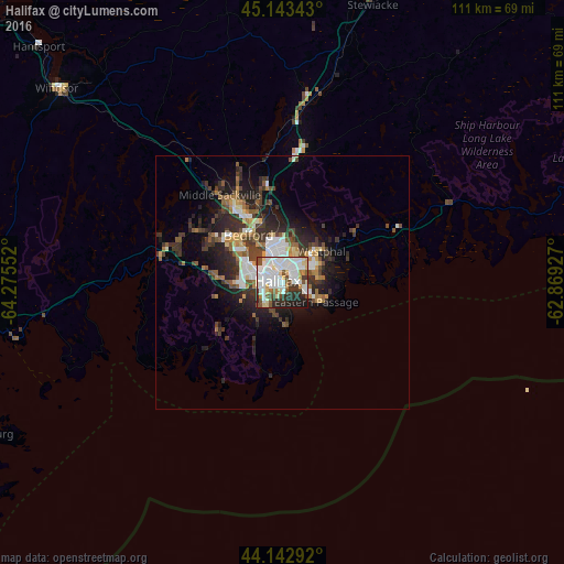
Analysis of Halifax night lights 2016
Square area 10x10 km:
 28.79%
90-99
23.03%80-89
8.64%70-79
3.03%60-69
2.12%50-59
5.61%40-49
5.76%30-39
7.88%20-29
11.06%10-19
4.09%0-9
0%Square area 50x50 km:
2.11%90-99
2.24%80-89
0.92%70-79
1.03%60-69
1.24%50-59
1.48%40-49
1.95%30-39
2.79%20-29
4.08%10-19
5.56%0-9
76.61%Clear (daylight) street map image can be seen on geolist.org.
Map coordinates:
45° 8' 36.3" North, 64° 16' 31.9" West
44° 38' 47" North, 63° 34' 22.5" West
44° 8' 34.5" North, 62° 52' 9.4" West
Some cities around Halifax sort by population:
• Dartmouth
2.8 km =1.7 mi,  353°
353°
• Lower Sackville
16.7 km =10.4 mi,  329°
329°
• Truro
83.7 km =52 mi,  16°
16°
• Cole Harbour
8.3 km =5.2 mi,  69°
69°
• Kentville
87.1 km =54.1 mi,  303°
303°
• Fall River
19.2 km =11.9 mi, 349°
• Bridgewater
80.7 km =50.1 mi,  248°
248°
• Greenwood
113.2 km =70.3 mi,  288°
288°
6324729 (p: 359,111)
Sources (retrieved 2019-11-25):
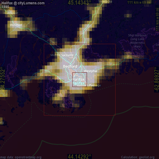
» NASA, Earths city lights 1995
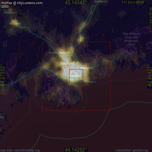
» NASA city lights 2003
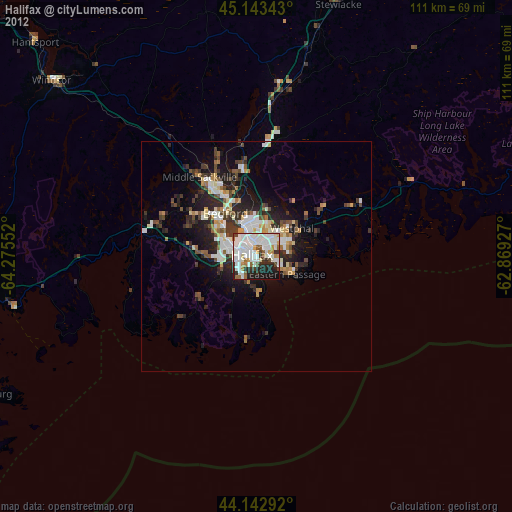
» Earth at Night: Flat Maps 2012, 2016