Cole Harbour night lights from space
Night Light of Cole Harbour (Nova Scotia) from space (Canada) Src. Average luminocity for 10x10km area is 40.2636% and for 50x50km: 11.4735%.
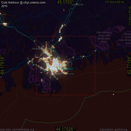
Analysis of Cole Harbour night lights 2016
Square area 10x10 km:
 6.52%
6.52%90-99
7.27%80-89
5.3%70-79
7.73%60-69
4.09%50-59
3.18%40-49
5.15%30-39
11.21%20-29
11.52%10-19
13.94%0-9
24.09%Square area 50x50 km:
2.16%90-99
2.25%80-89
0.9%70-79
1.08%60-69
1.18%50-59
1.41%40-49
1.9%30-39
2.53%20-29
3.91%10-19
5.48%0-9
77.19%Clear (daylight) street map image can be seen on geolist.org.
Map coordinates:
45° 10' 13.1" North, 64° 10' 41.5" West
44° 40' 20.8" North, 63° 28' 30.2" West
44° 10' 12.9" North, 62° 46' 19" West
Some cities around Cole Harbour sort by population:
• Halifax
8.3 km =5.2 mi,  249°
249°
• Dartmouth
8.1 km =5 mi,  269°
269°
• Lower Sackville
19.8 km =12.3 mi,  305°
305°
• Truro
79 km =49.1 mi,  12°
12°
• Kentville
92.2 km =57.3 mi,  299°
299°
• Fall River
19.5 km =12.1 mi,  325°
325°
• Bridgewater
89 km =55.3 mi, 248°
• Greenwood
119.7 km =74.4 mi,  286°
286°
7280414 (p: 20,000)
Sources (retrieved 2019-11-25):
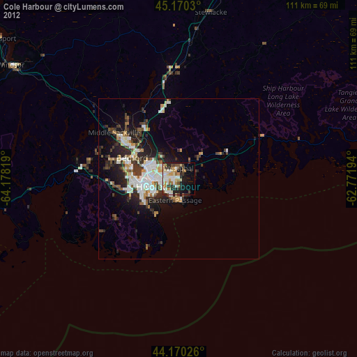
» Earth at Night: Flat Maps 2012, 2016