Grand Centre night lights from space
Night Light of Grand Centre (Alberta) from space (Canada) Src. Average luminocity for 10x10km area is 16.3433% and for 50x50km: 1.0392%.
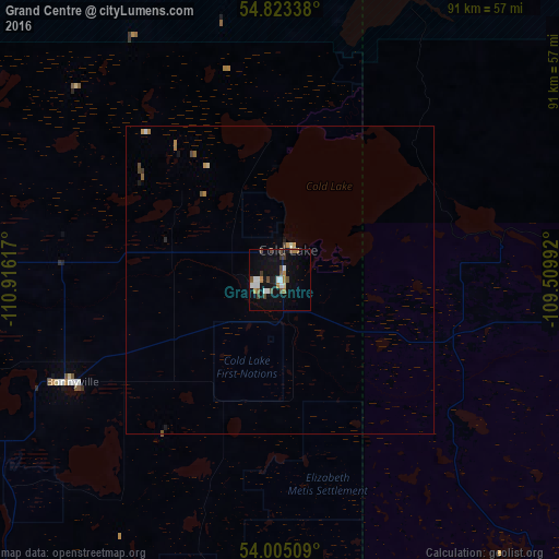
Analysis of Grand Centre night lights 2016
Square area 10x10 km:
 2.99%
2.99%90-99
2.27%80-89
0.48%70-79
1.2%60-69
2.63%50-59
1.79%40-49
4.55%30-39
1.56%20-29
0.36%10-19
11.84%0-9
70.33%Square area 50x50 km:
0.13%90-99
0.12%80-89
0.06%70-79
0.13%60-69
0.16%50-59
0.14%40-49
0.26%30-39
0.09%20-29
0.04%10-19
0.56%0-9
98.28%Clear (daylight) street map image can be seen on geolist.org.
Map coordinates:
54° 49' 24.2" North, 110° 54' 58.2" West
54° 24' 58.6" North, 110° 12' 46.9" West
54° 0' 18.3" North, 109° 30' 35.7" West
Some cities around Grand Centre sort by population:
• Lloydminster
127.8 km =79.4 mi,  174°
174°
• Fort Saskatchewan
211 km =131.1 mi,  248°
248°
• Cold Lake
5.8 km =3.6 mi,  20°
20°
• Bonnyville
37.7 km =23.4 mi,  243°
243°
• St. Paul
84.7 km =52.6 mi, 235°
• Vegreville
157.6 km =97.9 mi,  229°
229°
• Wainwright
180.8 km =112.3 mi,  193°
193°
• Meadow Lake
119.7 km =74.4 mi,  105°
105°
12070752 (p: 7,256)
Sources (retrieved 2019-11-25):
» Earth at Night: Flat Maps 2012, 2016