East York night lights from space
Night Light of East York (Ontario) from space (Canada) Src. Average luminocity for 10x10km area is 89.4652% and for 50x50km: 49.749%.
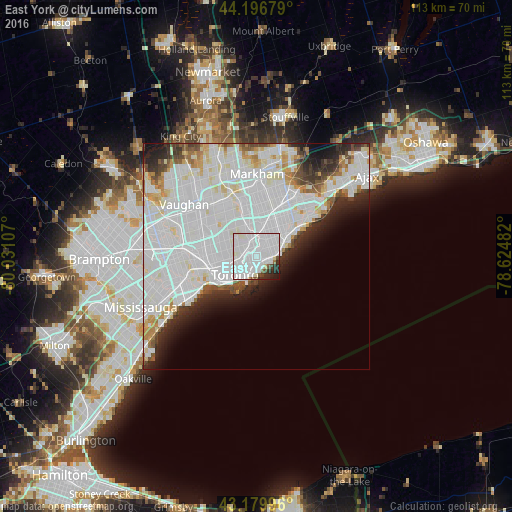
Analysis of East York night lights 2016
Square area 10x10 km:
 56.82%
90-99
26.67%80-89
1.36%70-79
0%60-69
1.06%50-59
2.42%40-49
2.12%30-39
2.88%20-29
5.15%10-19
1.52%0-9
0%Square area 50x50 km:
24.05%90-99
15.28%80-89
2.9%70-79
2.52%60-69
1.88%50-59
1.88%40-49
2.61%30-39
2.63%20-29
4.88%10-19
5.14%0-9
36.23%Clear (daylight) street map image can be seen on geolist.org.
Map coordinates:
44° 11' 48.4" North, 80° 1' 51.9" West
43° 41' 25.9" North, 79° 19' 40.6" West
43° 10' 47.9" North, 78° 37' 29.4" West
Some cities around East York sort by population:
• Toronto
7.2 km =4.5 mi,  278°
278°
• North York
11.1 km =6.9 mi,  320°
320°
• Scarborough
10.7 km =6.6 mi,  32°
32°
• Etobicoke
19.7 km =12.2 mi,  258°
258°
• Markham
20.2 km =12.6 mi,  14°
14°
• Vaughan
21.2 km =13.2 mi, 319°
• Willowdale
10.2 km =6.3 mi,  325°
325°
• Concord
17.4 km =10.8 mi,  314°
314°
7870925 (p: 115,365)
Sources (retrieved 2019-11-25):
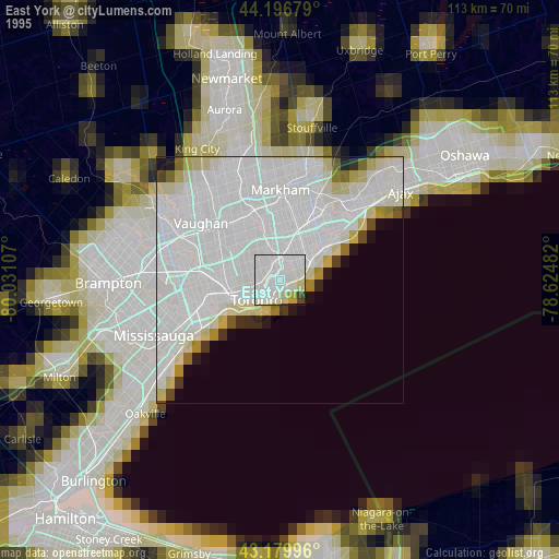
» NASA, Earths city lights 1995
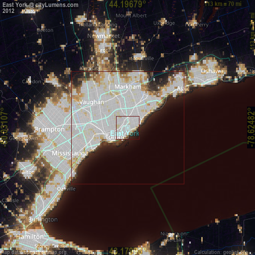
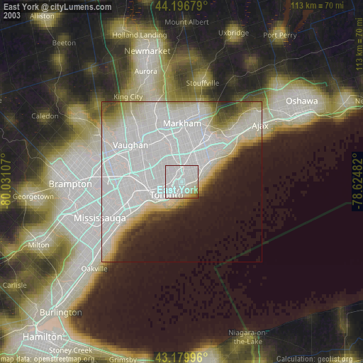
» NASA city lights 2003
» Earth at Night: Flat Maps 2012, 2016