Vaughan night lights from space
Night Light of Vaughan (Ontario) from space (Canada) Src. Average luminocity for 10x10km area is 95.1238% and for 50x50km: 62.8747%.
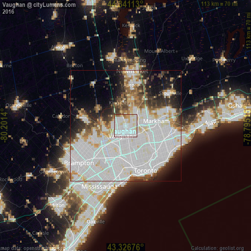
Analysis of Vaughan night lights 2016
Square area 10x10 km:
 48.1%
48.1%90-99
36.03%80-89
6.83%70-79
4.92%60-69
1.75%50-59
2.38%40-49
0%30-39
0%20-29
0%10-19
0%0-9
0%Square area 50x50 km:
29.48%90-99
17.27%80-89
4.04%70-79
3.34%60-69
3.64%50-59
3.64%40-49
4.31%30-39
4%20-29
6.1%10-19
7.23%0-9
16.96%Clear (daylight) street map image can be seen on geolist.org.
Map coordinates:
44° 20' 28.1" North, 80° 12' 5" West
43° 50' 10" North, 79° 29' 53.8" West
43° 19' 36.3" North, 78° 47' 42.5" West
Some cities around Vaughan sort by population:
• Toronto
16.5 km =10.3 mi,  156°
156°
• North York
10.1 km =6.3 mi,  139°
139°
• Markham
18.9 km =11.7 mi,  79°
79°
• Richmond Hill
6.3 km =3.9 mi,  51°
51°
• Willowdale
11.1 km =6.9 mi,  134°
134°
• Aurora
18.4 km =11.4 mi,  7°
7°
• Concord
4.2 km =2.6 mi, 162°
• King
16.1 km =10 mi,  332°
332°
6173577 (p: 238,866)
Sources (retrieved 2019-11-25):
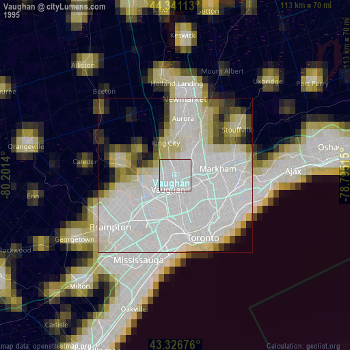
» NASA, Earths city lights 1995
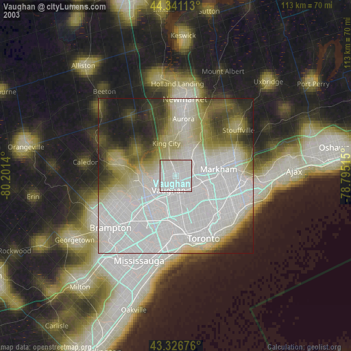
» NASA city lights 2003
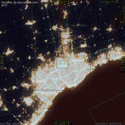
» Earth at Night: Flat Maps 2012, 2016