Carbonear night lights from space
Night Light of Carbonear (Newfoundland and Labrador) from space (Canada) Src. Average luminocity for 10x10km area is 8.9003% and for 50x50km: 2.0808%.
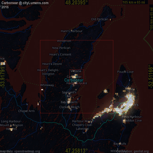
Analysis of Carbonear night lights 2016
Square area 10x10 km:
 0.3%
0.3%90-99
1.64%80-89
1.04%70-79
1.64%60-69
1.04%50-59
2.08%40-49
0.45%30-39
2.53%20-29
0.74%10-19
1.04%0-9
87.5%Square area 50x50 km:
0.13%90-99
0.37%80-89
0.12%70-79
0.24%60-69
0.28%50-59
0.45%40-49
0.4%30-39
0.34%20-29
0.37%10-19
1.35%0-9
95.95%Clear (daylight) street map image can be seen on geolist.org.
Map coordinates:
48° 12' 14.2" North, 53° 55' 4.5" West
47° 43' 59.5" North, 53° 12' 53.2" West
47° 15' 29.3" North, 52° 30' 42" West
Some cities around Carbonear sort by population:
• St. John's
42.2 km =26.2 mi,  116°
116°
• Mount Pearl
40.4 km =25.1 mi,  126°
126°
• Corner Brook
375.3 km =233.2 mi,  291°
291°
• Conception Bay South
30.6 km =19 mi,  147°
147°
• Bay Roberts
15.3 km =9.5 mi,  194°
194°
• Grand Falls-Windsor
224.9 km =139.7 mi,  306°
306°
• Saint-Pierre, PM
247.4 km =153.7 mi,  244°
244°
• Miquelon, PM
248.5 km =154.4 mi,  253°
253°
5916722 (p: 6,814)
Sources (retrieved 2019-11-25):
» Earth at Night: Flat Maps 2012, 2016