Bay Roberts night lights from space
Night Light of Bay Roberts (Newfoundland and Labrador) from space (Canada) Src. Average luminocity for 10x10km area is 6.9688% and for 50x50km: 2.2185%.
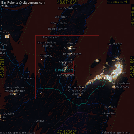
Analysis of Bay Roberts night lights 2016
Square area 10x10 km:
 0.28%
0.28%90-99
0.28%80-89
0%70-79
0.43%60-69
1.28%50-59
2.27%40-49
3.27%30-39
1.85%20-29
0.85%10-19
2.84%0-9
86.65%Square area 50x50 km:
0.12%90-99
0.3%80-89
0.14%70-79
0.22%60-69
0.31%50-59
0.53%40-49
0.5%30-39
0.49%20-29
0.25%10-19
1.59%0-9
95.58%Clear (daylight) street map image can be seen on geolist.org.
Map coordinates:
48° 4' 18.7" North, 53° 58' 4.5" West
47° 35' 59.6" North, 53° 15' 53.2" West
47° 7' 25" North, 52° 33' 42" West
Some cities around Bay Roberts sort by population:
• St. John's
41.8 km =26 mi,  95°
95°
• Mount Pearl
37.4 km =23.2 mi, 104°
• Corner Brook
377.9 km =234.8 mi,  293°
293°
• Conception Bay South
22.9 km =14.2 mi,  119°
119°
• Grand Falls-Windsor
231.4 km =143.8 mi,  309°
309°
• Carbonear
15.3 km =9.5 mi,  14°
14°
• Saint-Pierre, PM
238.2 km =148 mi,  247°
247°
• Miquelon, PM
241.3 km =149.9 mi,  256°
256°
5895424 (p: 13,737)
Sources (retrieved 2019-11-25):
» Earth at Night: Flat Maps 2012, 2016