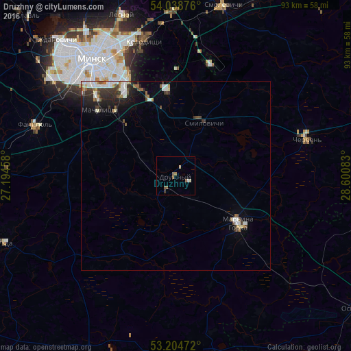
Druzhny night lights from space
Night Light of Druzhny (Minsk) from space (Belarus) Src. Average luminocity for 10x10km area is 3.9129% and for 50x50km: 3.2779%.
Analysis of Druzhny night lights 2016
Square area 10x10 km:
 0.13%
0.13%90-99
0.88%80-89
0.51%70-79
0%60-69
0.88%50-59
2.15%40-49
0%30-39
0.51%20-29
0%10-19
0.13%0-9
94.82%Square area 50x50 km:
0.61%90-99
0.73%80-89
0.22%70-79
0.17%60-69
0.41%50-59
0.35%40-49
0.41%30-39
0.71%20-29
0.81%10-19
1.48%0-9
94.1%Clear (daylight) street map image can be seen on geolist.org.
Map coordinates:
54° 2' 19.5" North, 27° 11' 40.5" East
53° 37' 25.7" North, 27° 53' 51.7" East
53° 12' 17" North, 28° 36' 3" East
Some cities around Druzhny sort by population:
• Minsk
37.6 km =23.4 mi,  324°
324°
• Mar’’ina Horka
20.8 km =12.9 mi,  127°
127°
• Kalodzishchy
36.4 km =22.6 mi,  347°
347°
• Fanipol
39.7 km =24.7 mi,  290°
290°
• Chervyen’
36.3 km =22.6 mi,  75°
75°
• Machulishchy
26.4 km =16.4 mi,  310°
310°
• Hatava
24.5 km =15.2 mi, 316°
• Smilavichy
15.9 km =9.9 mi,  28°
28°
8020004 (p: 8,978)
Sources (retrieved 2019-11-25):
» Earth at Night: Flat Maps 2012, 2016