Minsk night lights from space
Night Light of Minsk (Minsk City) from space (Belarus) Src. Average luminocity for 10x10km area is 97.2262% and for 50x50km: 16.7848%.
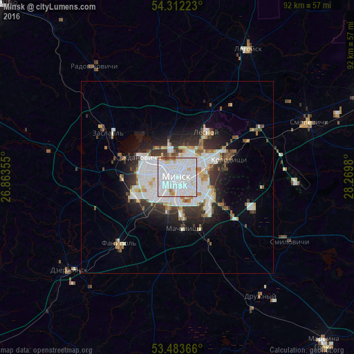
Analysis of Minsk night lights 2016
Square area 10x10 km:
 54.89%
90-99
37.04%80-89
3.7%70-79
2.12%60-69
1.19%50-59
0.79%40-49
0.26%30-39
0%20-29
0%10-19
0%0-9
0%Square area 50x50 km:
5.56%90-99
4.32%80-89
1.22%70-79
0.95%60-69
1.37%50-59
1.14%40-49
1.27%30-39
2.3%20-29
3.6%10-19
5.71%0-9
72.56%Clear (daylight) street map image can be seen on geolist.org.
Map coordinates:
54° 18' 44" North, 26° 51' 48.8" East
53° 54' 0" North, 27° 34' 0" East
53° 29' 1.2" North, 28° 16' 11.3" East
Some cities around Minsk sort by population:
• Kalodzishchy
14.9 km =9.3 mi,  70°
70°
• Lyasny
14.6 km =9.1 mi,  35°
35°
• Zaslawye
23.1 km =14.4 mi,  302°
302°
• Fanipol
22.6 km =14 mi,  222°
222°
• Hatava
13.9 km =8.6 mi,  159°
159°
• Machulishchy
13.6 km =8.5 mi,  172°
172°
• Rakaw
34.2 km =21.3 mi,  282°
282°
• Smilavichy
33.6 km =20.9 mi,  119°
119°
625144 (p: 1,742,124)
Sources (retrieved 2019-11-25):
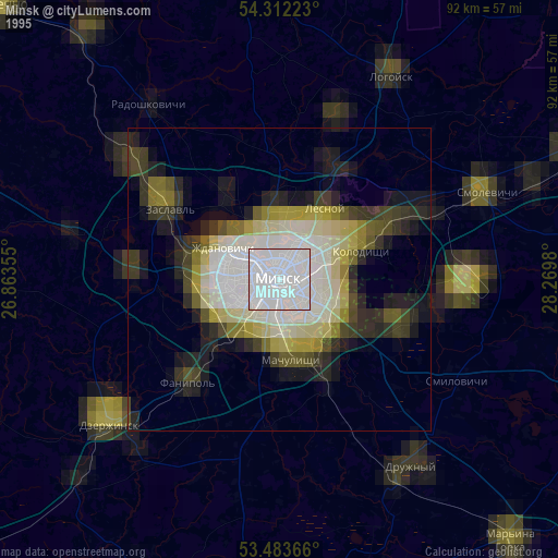
» NASA, Earths city lights 1995
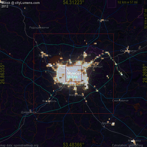
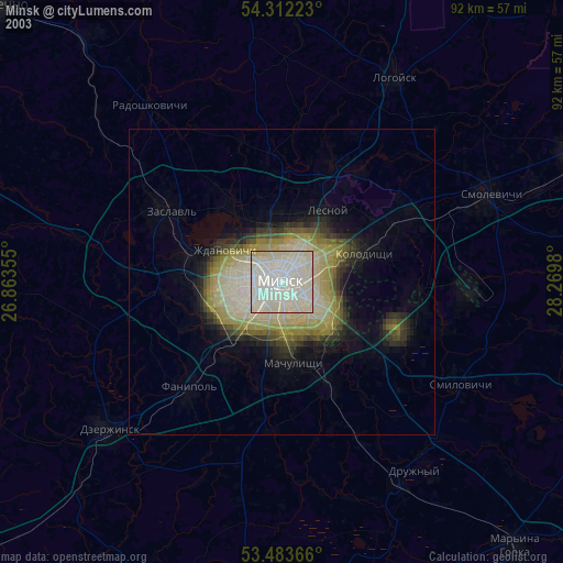
» NASA city lights 2003
» Earth at Night: Flat Maps 2012, 2016