Hatava night lights from space
Night Light of Hatava (Minsk) from space (Belarus) Src. Average luminocity for 10x10km area is 22.082% and for 50x50km: 16.689%.
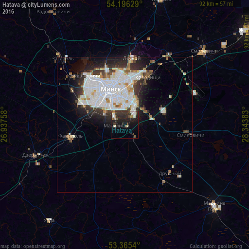
Analysis of Hatava night lights 2016
Square area 10x10 km:
 1.98%
1.98%90-99
4.76%80-89
1.19%70-79
0.93%60-69
1.72%50-59
2.65%40-49
3.17%30-39
7.14%20-29
12.3%10-19
20.63%0-9
43.52%Square area 50x50 km:
5.58%90-99
4.37%80-89
1.22%70-79
0.94%60-69
1.37%50-59
1.15%40-49
1.22%30-39
2.34%20-29
3.59%10-19
5.36%0-9
72.87%Clear (daylight) street map image can be seen on geolist.org.
Map coordinates:
54° 11' 46.6" North, 26° 56' 15.3" East
53° 46' 58.4" North, 27° 38' 26.5" East
53° 21' 55.4" North, 28° 20' 37.8" East
Some cities around Hatava sort by population:
• Minsk
13.9 km =8.6 mi,  339°
339°
• Dzyarzhynsk
34.9 km =21.7 mi,  251°
251°
• Kalodzishchy
20.2 km =12.6 mi,  27°
27°
• Lyasny
25.2 km =15.7 mi,  8°
8°
• Fanipol
20.5 km =12.7 mi,  259°
259°
• Druzhny
24.5 km =15.2 mi,  136°
136°
• Machulishchy
3 km =1.9 mi, 261°
• Smilavichy
24.6 km =15.3 mi,  98°
98°
628511 (p: 8,000)
Sources (retrieved 2019-11-25):
» Earth at Night: Flat Maps 2012, 2016