Asipovichy night lights from space
Night Light of Asipovichy (Mogilev) from space (Belarus) Src. Average luminocity for 10x10km area is 3.6111% and for 50x50km: 0.1562%.
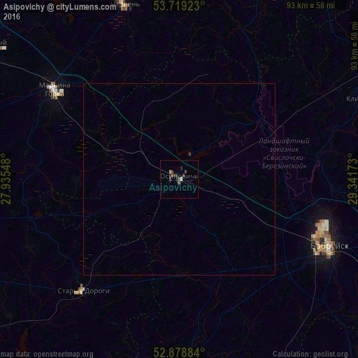
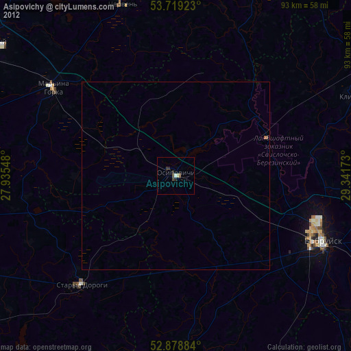
Analysis of Asipovichy night lights 2016
Square area 10x10 km:
 0%
0%90-99
0.51%80-89
0%70-79
0.51%60-69
0%50-59
0.76%40-49
1.52%30-39
2.15%20-29
1.52%10-19
0.13%0-9
92.93%Square area 50x50 km:
0%90-99
0.02%80-89
0%70-79
0.02%60-69
0%50-59
0.03%40-49
0.06%30-39
0.11%20-29
0.06%10-19
0.01%0-9
99.69%Clear (daylight) street map image can be seen on geolist.org.
Map coordinates:
53° 43' 9.2" North, 27° 56' 7.7" East
53° 18' 4" North, 28° 38' 19" East
52° 52' 43.8" North, 29° 20' 30.2" East
Some cities around Asipovichy sort by population:
• Babruysk
42.8 km =26.6 mi,  114°
114°
• Mar’’ina Horka
40 km =24.9 mi,  305°
305°
• Staryya Darohi
38.1 km =23.7 mi,  220°
220°
• Chervyen’
47.1 km =29.3 mi,  343°
343°
• Druzhny
60.8 km =37.8 mi, 306°
• Kirawsk
55.7 km =34.6 mi,  93°
93°
• Hlusk
44.4 km =27.6 mi,  176°
176°
• Klichaw
50.9 km =31.6 mi,  65°
65°
624034 (p: 34,591)
Sources (retrieved 2019-11-25):
» Earth at Night: Flat Maps 2012, 2016