Caieiras night lights from space
Night Light of Caieiras (São Paulo) from space (Brazil) Src. Average luminocity for 10x10km area is 72.125% and for 50x50km: 64.6707%.
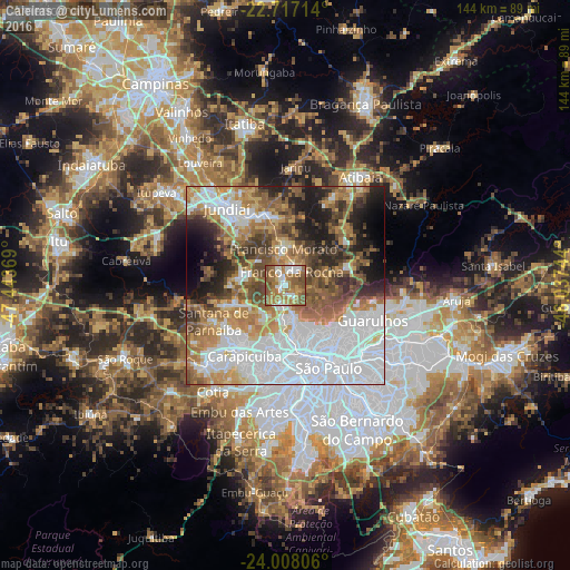
Analysis of Caieiras night lights 2016
Square area 10x10 km:
 9.85%
9.85%90-99
15.15%80-89
6.82%70-79
12.5%60-69
25.95%50-59
25.38%40-49
4.36%30-39
0%20-29
0%10-19
0%0-9
0%Square area 50x50 km:
25.08%90-99
9.01%80-89
5.06%70-79
8.69%60-69
9.98%50-59
9.53%40-49
7.74%30-39
5.66%20-29
7.09%10-19
7.71%0-9
4.44%Clear (daylight) street map image can be seen on geolist.org.
Map coordinates:
22° 43' 1.7" South, 47° 26' 37.3" West
23° 21' 51" South, 46° 44' 26" West
24° 0' 29" South, 46° 2' 14.8" West
Some cities around Caieiras sort by population:
• Osasco
19.4 km =12.1 mi,  195°
195°
• Carapicuíba
20.1 km =12.5 mi,  208°
208°
• Francisco Morato
9.2 km =5.7 mi,  356°
356°
• Várzea Paulista
19.2 km =11.9 mi,  332°
332°
• Franco da Rocha
4.9 km =3 mi,  16°
16°
• Santana de Parnaíba
20.2 km =12.6 mi,  243°
243°
• Cajamar
13.9 km =8.6 mi,  273°
273°
• Mairiporã
16.5 km =10.3 mi,  72°
72°
3468215 (p: 87,188)
Sources (retrieved 2019-11-25):
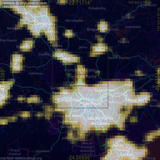
» NASA, Earths city lights 1995
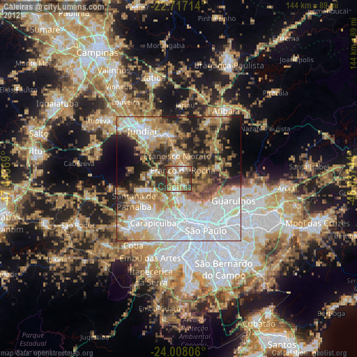
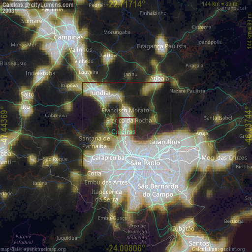
» NASA city lights 2003
» Earth at Night: Flat Maps 2012, 2016