Varginha night lights from space
Night Light of Varginha (Minas Gerais) from space (Brazil) Src. Average luminocity for 10x10km area is 47.0682% and for 50x50km: 6.3356%.
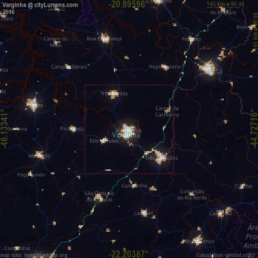
Analysis of Varginha night lights 2016
Square area 10x10 km:
 11.17%
90-99
12.31%80-89
4.73%70-79
7.2%60-69
4.36%50-59
2.84%40-49
3.98%30-39
3.79%20-29
7.77%10-19
33.14%0-9
8.71%Square area 50x50 km:
0.82%90-99
1.06%80-89
0.7%70-79
1.2%60-69
0.79%50-59
0.48%40-49
0.5%30-39
0.46%20-29
0.78%10-19
5.68%0-9
87.52%Clear (daylight) street map image can be seen on geolist.org.
Map coordinates:
20° 53' 45.5" South, 46° 8' 0.3" West
21° 33' 5" South, 45° 25' 49" West
22° 12' 13.9" South, 44° 43' 37.8" West
Some cities around Varginha sort by population:
• Três Corações
24.4 km =15.2 mi,  131°
131°
• Três Pontas
22.2 km =13.8 mi,  337°
337°
• São Gonçalo do Sapucaí
41.6 km =25.8 mi,  204°
204°
• Elói Mendes
15.4 km =9.6 mi,  244°
244°
• Nepomuceno
40.7 km =25.3 mi,  29°
29°
• Paraguaçu
31.8 km =19.8 mi,  270°
270°
• Campanha
31.8 km =19.8 mi,  174°
174°
• Cambuquira
36.2 km =22.5 mi,  157°
157°
3445487 (p: 116,571)
Sources (retrieved 2019-11-25):
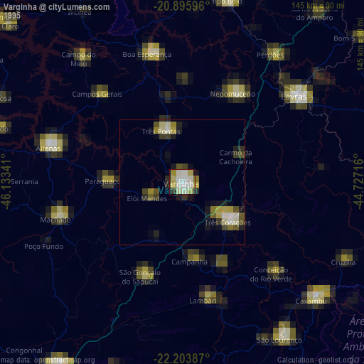
» NASA, Earths city lights 1995
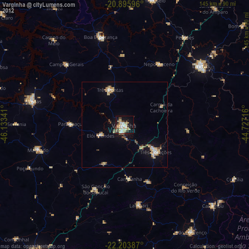
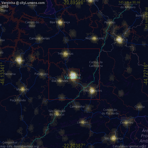
» NASA city lights 2003
» Earth at Night: Flat Maps 2012, 2016