Três Corações night lights from space
Night Light of Três Corações (Minas Gerais) from space (Brazil) Src. Average luminocity for 10x10km area is 34.5909% and for 50x50km: 5.554%.
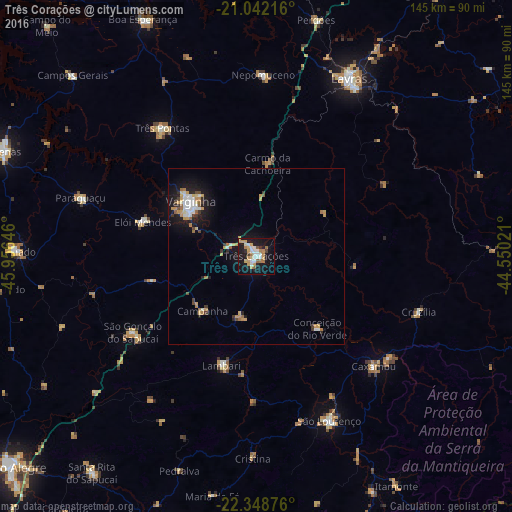
Analysis of Três Corações night lights 2016
Square area 10x10 km:
 5.11%
5.11%90-99
7.01%80-89
3.41%70-79
8.52%60-69
5.3%50-59
2.08%40-49
1.33%30-39
0.95%20-29
4.17%10-19
41.1%0-9
21.02%Square area 50x50 km:
0.73%90-99
0.93%80-89
0.49%70-79
1.19%60-69
0.78%50-59
0.32%40-49
0.39%30-39
0.51%20-29
0.82%10-19
5.31%0-9
88.52%Clear (daylight) street map image can be seen on geolist.org.
Map coordinates:
21° 2' 31.8" South, 45° 57' 23.3" West
21° 41' 49" South, 45° 15' 12" West
22° 20' 55.5" South, 44° 33' 0.8" West
Some cities around Três Corações sort by population:
• Varginha
24.4 km =15.2 mi,  311°
311°
• Caxambu
45.5 km =28.3 mi,  133°
133°
• São Gonçalo do Sapucaí
41.4 km =25.7 mi,  238°
238°
• Elói Mendes
33.7 km =20.9 mi,  286°
286°
• Lambari
32.6 km =20.3 mi,  197°
197°
• Campanha
21.7 km =13.5 mi,  224°
224°
• Conceição do Rio Verde
26.8 km =16.7 mi,  139°
139°
• Cambuquira
17.8 km =11.1 mi,  194°
194°
3446138 (p: 63,457)
Sources (retrieved 2019-11-25):
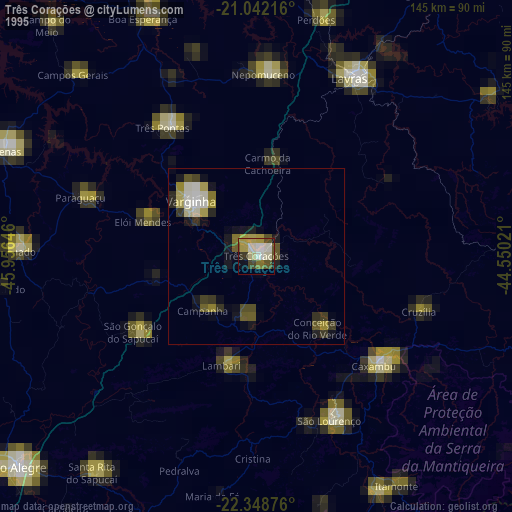
» NASA, Earths city lights 1995
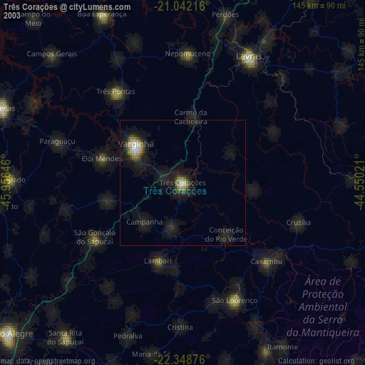
» NASA city lights 2003
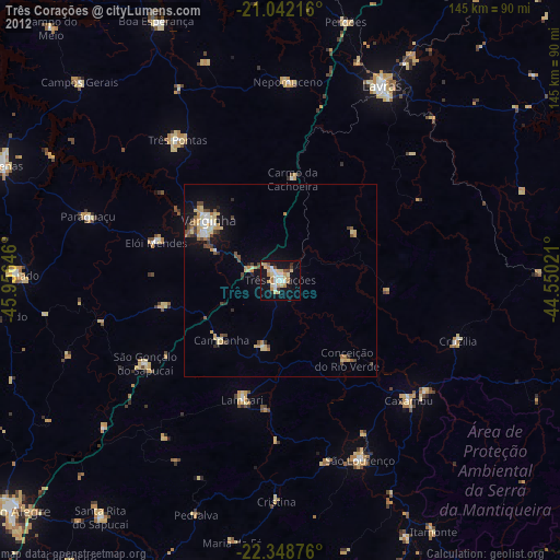
» Earth at Night: Flat Maps 2012, 2016