Campanha night lights from space
Night Light of Campanha (Minas Gerais) from space (Brazil) Src. Average luminocity for 10x10km area is 6.8373% and for 50x50km: 4.4079%.
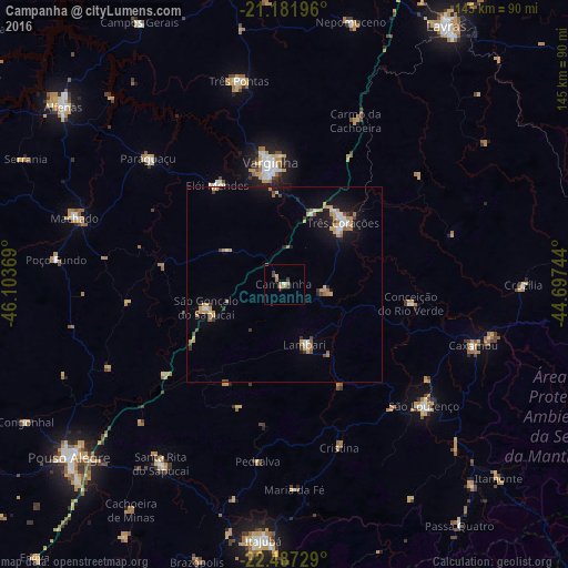
Analysis of Campanha night lights 2016
Square area 10x10 km:
 0%
0%90-99
0.79%80-89
0.6%70-79
1.79%60-69
2.38%50-59
0%40-49
1.59%30-39
1.98%20-29
0.2%10-19
0.6%0-9
90.08%Square area 50x50 km:
0.34%90-99
0.52%80-89
0.51%70-79
1.06%60-69
0.74%50-59
0.26%40-49
0.49%30-39
0.52%20-29
0.39%10-19
3.02%0-9
92.17%Clear (daylight) street map image can be seen on geolist.org.
Map coordinates:
21° 10' 55.1" South, 46° 6' 13.3" West
21° 50' 10" South, 45° 24' 2" West
22° 29' 14.2" South, 44° 41' 50.8" West
Some cities around Campanha sort by population:
• Varginha
31.8 km =19.8 mi,  354°
354°
• Três Corações
21.7 km =13.5 mi,  44°
44°
• São Lourenço
47.4 km =29.5 mi,  131°
131°
• São Gonçalo do Sapucaí
21 km =13 mi,  252°
252°
• Elói Mendes
30.4 km =18.9 mi,  325°
325°
• Lambari
16.3 km =10.1 mi,  161°
161°
• Conceição do Rio Verde
32.9 km =20.4 mi,  98°
98°
• Cambuquira
11 km =6.8 mi, 99°
3467928 (p: 12,506)
Sources (retrieved 2019-11-25):
» Earth at Night: Flat Maps 2012, 2016