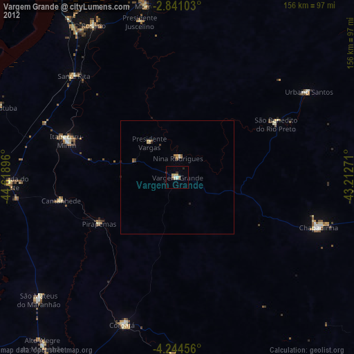
Vargem Grande night lights from space
Night Light of Vargem Grande (Maranhão) from space (Brazil) Src. Average luminocity for 10x10km area is 13.3961% and for 50x50km: 1.1147%.
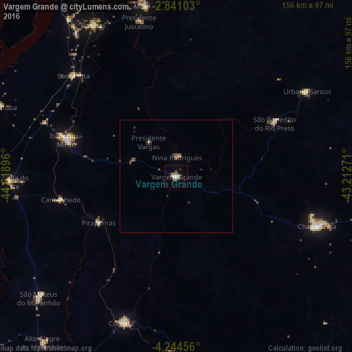
Analysis of Vargem Grande night lights 2016
Square area 10x10 km:
 0.65%
0.65%90-99
1.95%80-89
3.46%70-79
0%60-69
1.52%50-59
2.81%40-49
1.73%30-39
2.81%20-29
2.38%10-19
0.87%0-9
81.82%Square area 50x50 km:
0.03%90-99
0.12%80-89
0.16%70-79
0.02%60-69
0.2%50-59
0.25%40-49
0.35%30-39
0.29%20-29
0.26%10-19
0.11%0-9
98.22%Clear (daylight) street map image can be seen on geolist.org.
Map coordinates:
2° 50' 27.7" South, 44° 37' 8.3" West
3° 32' 35" South, 43° 54' 57" West
4° 14' 40.4" South, 43° 12' 45.8" West
Some cities around Vargem Grande sort by population:
• Chapadinha
65.5 km =40.7 mi,  109°
109°
• Itapecuru Mirim
51.9 km =32.2 mi,  288°
288°
• Coroatá
69.2 km =43 mi,  199°
199°
• Santa Rita
36.2 km =22.5 mi,  170°
170°
• Urbano Santos
68 km =42.3 mi,  56°
56°
• São Benedito do Rio Preto
48.9 km =30.4 mi, 61°
• Cantanhede
52.1 km =32.4 mi,  258°
258°
• Pirapemas
39.8 km =24.7 mi,  239°
239°
3385538 (p: 21,419)
Sources (retrieved 2019-11-25):
» Earth at Night: Flat Maps 2012, 2016