União night lights from space
Night Light of União (Piauí) from space (Brazil) Src. Average luminocity for 10x10km area is 15.0021% and for 50x50km: 0.9438%.
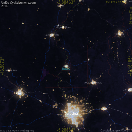
Analysis of União night lights 2016
Square area 10x10 km:
 1.86%
1.86%90-99
4.75%80-89
0.83%70-79
0%60-69
1.86%50-59
3.72%40-49
1.03%30-39
0.83%20-29
1.65%10-19
2.07%0-9
81.4%Square area 50x50 km:
0.08%90-99
0.2%80-89
0.03%70-79
0%60-69
0.16%50-59
0.22%40-49
0.21%30-39
0.09%20-29
0.22%10-19
0.17%0-9
98.61%Clear (daylight) street map image can be seen on geolist.org.
Map coordinates:
3° 53' 4.7" South, 43° 34' 2.3" West
4° 35' 9" South, 42° 51' 51" West
5° 17' 10.8" South, 42° 9' 39.8" West
Some cities around União sort by population:
• Teresina
56.4 km =35 mi,  172°
172°
• Caxias
62.4 km =38.8 mi,  240°
240°
• Timon
56.6 km =35.2 mi,  176°
176°
• Coelho Neto
40.1 km =24.9 mi,  335°
335°
• Altos
67.3 km =41.8 mi,  138°
138°
• Barras
73.7 km =45.8 mi,  58°
58°
• José de Freitas
37.2 km =23.1 mi,  120°
120°
• Miguel Alves
46.9 km =29.1 mi,  355°
355°
3385745 (p: 15,677)
Sources (retrieved 2019-11-25):
» Earth at Night: Flat Maps 2012, 2016