Feira de Santana night lights from space
Night Light of Feira de Santana (Bahia) from space (Brazil) Src. Average luminocity for 10x10km area is 86.969% and for 50x50km: 25.3437%.
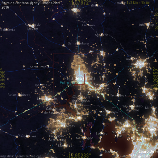
Analysis of Feira de Santana night lights 2016
Square area 10x10 km:
 47.11%
90-99
24.79%80-89
4.13%70-79
2.07%60-69
5.58%50-59
5.58%40-49
4.34%30-39
4.55%20-29
1.86%10-19
0%0-9
0%Square area 50x50 km:
2.82%90-99
4.39%80-89
1.65%70-79
2.2%60-69
5.03%50-59
5.94%40-49
5.05%30-39
3.99%20-29
7.1%10-19
15.48%0-9
46.35%Clear (daylight) street map image can be seen on geolist.org.
Map coordinates:
11° 34' 43.4" South, 39° 40' 11.3" West
12° 16' 0" South, 38° 58' 0" West
12° 57' 10.2" South, 38° 15' 48.8" West
Some cities around Feira de Santana sort by population:
• Santo Estêvão
35.9 km =22.3 mi,  239°
239°
• Conceição do Jacuípe
22.4 km =13.9 mi,  104°
104°
• Cachoeira
37.2 km =23.1 mi,  179°
179°
• Conceição da Feira
26.8 km =16.7 mi,  187°
187°
• São Gonçalo dos Campos
18.5 km =11.5 mi, 180°
• Anguera
33 km =20.5 mi,  292°
292°
• Irará
32.4 km =20.1 mi,  42°
42°
• Coração de Maria
23.8 km =14.8 mi,  81°
81°
3463478 (p: 481,911)
Sources (retrieved 2019-11-25):
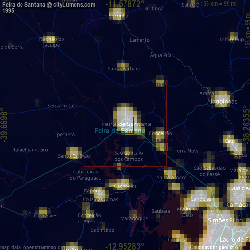
» NASA, Earths city lights 1995
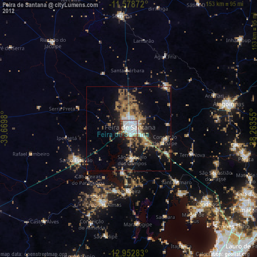
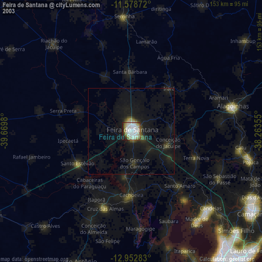
» NASA city lights 2003
» Earth at Night: Flat Maps 2012, 2016