São Sepé night lights from space
Night Light of São Sepé (Rio Grande do Sul) from space (Brazil) Src. Average luminocity for 10x10km area is 11.3339% and for 50x50km: 0.6468%.
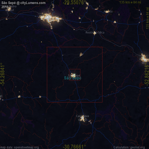
Analysis of São Sepé night lights 2016
Square area 10x10 km:
 0.7%
0.7%90-99
1.4%80-89
2.1%70-79
1.4%60-69
2.97%50-59
1.4%40-49
1.75%30-39
1.05%20-29
1.22%10-19
1.05%0-9
84.97%Square area 50x50 km:
0.03%90-99
0.06%80-89
0.12%70-79
0.06%60-69
0.15%50-59
0.12%40-49
0.07%30-39
0.19%20-29
0.08%10-19
0.04%0-9
99.07%Clear (daylight) street map image can be seen on geolist.org.
Map coordinates:
29° 33' 2.7" South, 54° 16' 6.3" West
30° 9' 38" South, 53° 33' 55" West
30° 45' 59.8" South, 52° 51' 43.8" West
Some cities around São Sepé sort by population:
• Santa Maria
57.9 km =36 mi,  336°
336°
• Cachoeira do Sul
66 km =41 mi,  78°
78°
• São Gabriel
75.1 km =46.7 mi,  254°
254°
• Candelária
92.6 km =57.5 mi,  53°
53°
• Júlio de Castilhos
104.4 km =64.9 mi,  353°
353°
• Caçapava do Sul
40.1 km =24.9 mi,  168°
168°
• Encruzilhada do Sul
108.8 km =67.6 mi,  113°
113°
• São Pedro do Sul
84.3 km =52.4 mi,  315°
315°
3448207 (p: 19,181)
Sources (retrieved 2019-11-25):
» Earth at Night: Flat Maps 2012, 2016