São Gabriel night lights from space
Night Light of São Gabriel (Rio Grande do Sul) from space (Brazil) Src. Average luminocity for 10x10km area is 35.8993% and for 50x50km: 1.9084%.
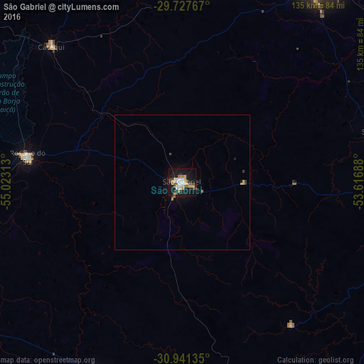
Analysis of São Gabriel night lights 2016
Square area 10x10 km:
 6.04%
6.04%90-99
7.14%80-89
4.4%70-79
5.86%60-69
3.11%50-59
3.11%40-49
6.04%30-39
2.38%20-29
2.75%10-19
41.76%0-9
17.4%Square area 50x50 km:
0.24%90-99
0.29%80-89
0.25%70-79
0.3%60-69
0.16%50-59
0.16%40-49
0.28%30-39
0.22%20-29
0.16%10-19
1.98%0-9
95.96%Clear (daylight) street map image can be seen on geolist.org.
Map coordinates:
29° 43' 39.6" South, 55° 1' 23.3" West
30° 20' 11" South, 54° 19' 12" West
30° 56' 28.9" South, 53° 37' 0.8" West
Some cities around São Gabriel sort by population:
• Santa Maria
87.7 km =54.5 mi,  34°
34°
• Bagé
112.5 km =69.9 mi,  169°
169°
• Dom Pedrito
79.4 km =49.3 mi,  205°
205°
• Rosário do Sul
57.7 km =35.9 mi,  278°
278°
• São Sepé
75.1 km =46.7 mi,  74°
74°
• Caçapava do Sul
82.5 km =51.3 mi,  103°
103°
• Cacequi
70 km =43.5 mi,  316°
316°
• São Pedro do Sul
80.7 km =50.1 mi,  9°
9°
3449099 (p: 55,434)
Sources (retrieved 2019-11-25):
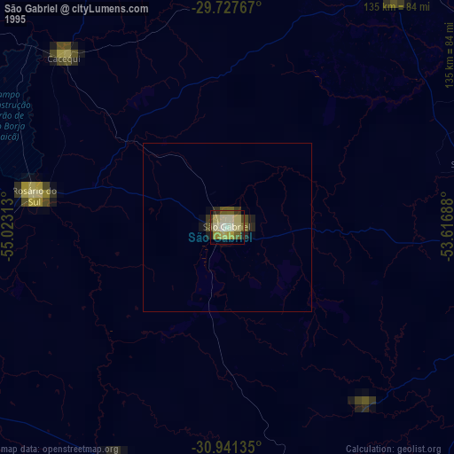
» NASA, Earths city lights 1995
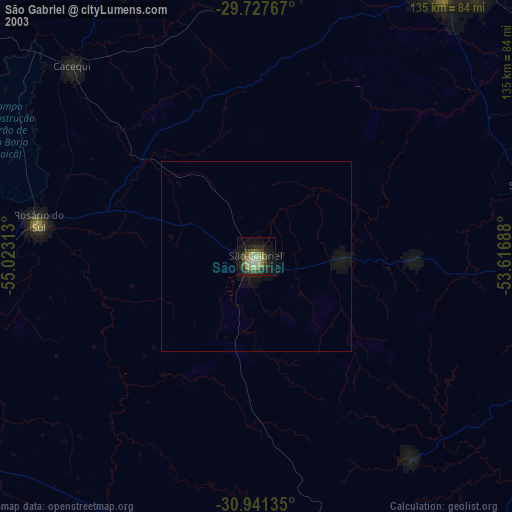
» NASA city lights 2003
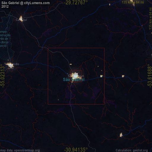
» Earth at Night: Flat Maps 2012, 2016