São Miguel dos Campos night lights from space
Night Light of São Miguel dos Campos (Alagoas) from space (Brazil) Src. Average luminocity for 10x10km area is 35.5606% and for 50x50km: 8.0286%.
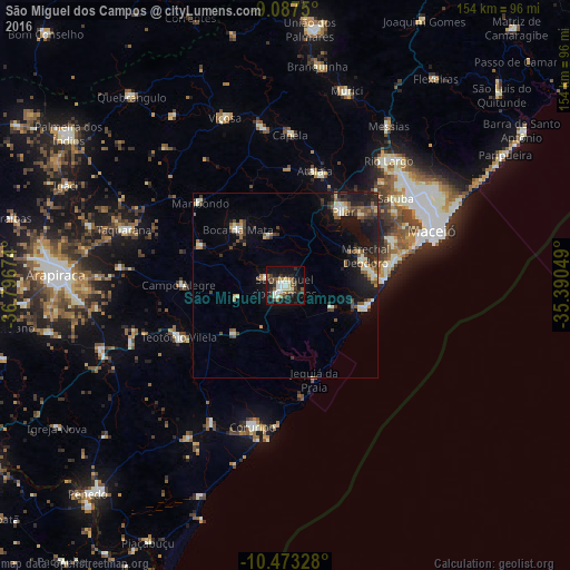
Analysis of São Miguel dos Campos night lights 2016
Square area 10x10 km:
 2.6%
2.6%90-99
11.9%80-89
1.73%70-79
1.08%60-69
4.98%50-59
8.44%40-49
0.87%30-39
10.39%20-29
8.44%10-19
32.9%0-9
16.67%Square area 50x50 km:
0.36%90-99
1.83%80-89
0.54%70-79
0.57%60-69
0.96%50-59
1.45%40-49
1.23%30-39
1.52%20-29
2.18%10-19
7.11%0-9
82.24%Clear (daylight) street map image can be seen on geolist.org.
Map coordinates:
9° 5' 15" South, 36° 47' 48.3" West
9° 46' 52" South, 36° 5' 37" West
10° 28' 23.8" South, 35° 23' 25.8" West
Some cities around São Miguel dos Campos sort by population:
• Marechal Deodoro
23.1 km =14.4 mi,  70°
70°
• Coruripe
39.3 km =24.4 mi,  193°
193°
• Pilar
25.4 km =15.8 mi,  36°
36°
• Atalaia
32 km =19.9 mi,  14°
14°
• Campo Alegre
28.2 km =17.5 mi,  269°
269°
• Satuba
38.2 km =23.7 mi,  50°
50°
• Maribondo
32.4 km =20.1 mi,  314°
314°
• Anadia
25.5 km =15.8 mi,  294°
294°
3388269 (p: 40,890)
Sources (retrieved 2019-11-25):
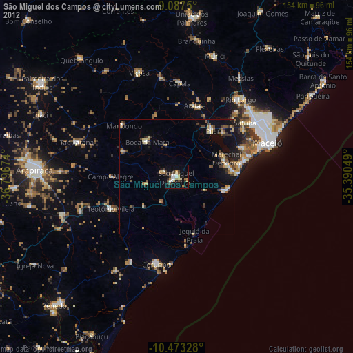
» Earth at Night: Flat Maps 2012, 2016