Santo Antônio do Tauá night lights from space
Night Light of Santo Antônio do Tauá (Pará) from space (Brazil) Src. Average luminocity for 10x10km area is 11.3225% and for 50x50km: 12.8618%.
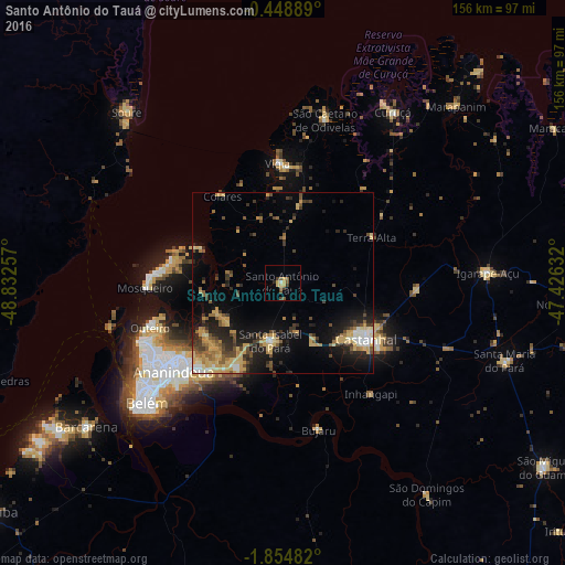
Analysis of Santo Antônio do Tauá night lights 2016
Square area 10x10 km:
 0%
0%90-99
0.87%80-89
3.46%70-79
1.73%60-69
0%50-59
3.9%40-49
1.52%30-39
3.25%20-29
0.87%10-19
0%0-9
84.42%Square area 50x50 km:
0.71%90-99
1.18%80-89
2.82%70-79
2.62%60-69
1.25%50-59
2.08%40-49
2.05%30-39
2.13%20-29
3.46%10-19
7.64%0-9
74.06%Clear (daylight) street map image can be seen on geolist.org.
Map coordinates:
0° 26' 56" South, 48° 49' 57.3" West
1° 9' 7" South, 48° 7' 46" West
1° 51' 17.4" South, 47° 25' 34.8" West
Some cities around Santo Antônio do Tauá sort by population:
• Belém
53.7 km =33.4 mi,  230°
230°
• Ananindeua
36 km =22.4 mi, 228°
• Castanhal
27.5 km =17.1 mi,  124°
124°
• Benevides
26.6 km =16.5 mi,  208°
208°
• Vigia
32.7 km =20.3 mi,  357°
357°
• Curuçá
56.5 km =35.1 mi,  33°
33°
• São Caetano de Odivelas
46.3 km =28.8 mi,  15°
15°
• Bujaru
41.5 km =25.8 mi,  166°
166°
3389062 (p: 8,921)
Sources (retrieved 2019-11-25):
» Earth at Night: Flat Maps 2012, 2016