Bujaru night lights from space
Night Light of Bujaru (Pará) from space (Brazil) Src. Average luminocity for 10x10km area is 4.6537% and for 50x50km: 5.8316%.
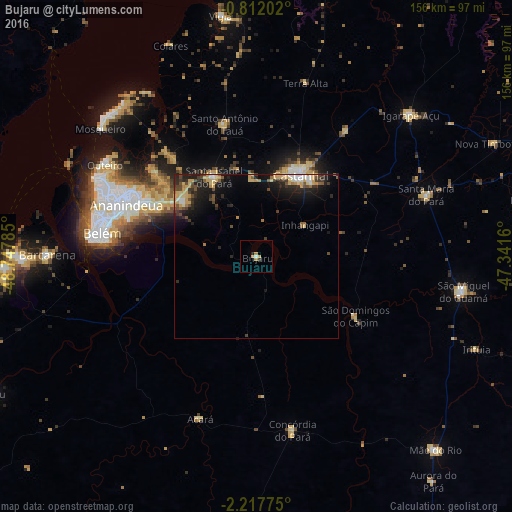
Analysis of Bujaru night lights 2016
Square area 10x10 km:
 0.65%
0.65%90-99
0.22%80-89
1.52%70-79
1.3%60-69
0.65%50-59
0%40-49
0%30-39
0.87%20-29
0.22%10-19
0.65%0-9
93.94%Square area 50x50 km:
0.38%90-99
0.58%80-89
1.21%70-79
1.19%60-69
0.34%50-59
0.7%40-49
1.13%30-39
0.94%20-29
2.07%10-19
4.27%0-9
87.18%Clear (daylight) street map image can be seen on geolist.org.
Map coordinates:
0° 48' 43.3" South, 48° 44' 52.3" West
1° 30' 54" South, 48° 2' 41" West
2° 13' 3.9" South, 47° 20' 29.8" West
Some cities around Bujaru sort by population:
• Belém
51.5 km =32 mi,  277°
277°
• Ananindeua
40 km =24.9 mi,  294°
294°
• Castanhal
27.9 km =17.3 mi,  28°
28°
• Benevides
28 km =17.4 mi,  307°
307°
• São Miguel do Guamá
63.6 km =39.5 mi,  101°
101°
• Santa Maria do Pará
55.3 km =34.4 mi,  70°
70°
• Acará
52.4 km =32.6 mi,  198°
198°
• Santo Antônio do Tauá
41.5 km =25.8 mi,  346°
346°
3404760 (p: 6,189)
Sources (retrieved 2019-11-25):
» Earth at Night: Flat Maps 2012, 2016