Santarém night lights from space
Night Light of Santarém (Pará) from space (Brazil) Src. Average luminocity for 10x10km area is 69.3701% and for 50x50km: 6.3437%.
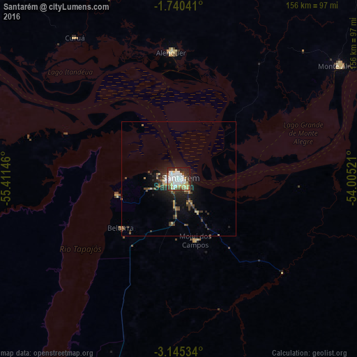
Analysis of Santarém night lights 2016
Square area 10x10 km:
 23.16%
90-99
19.7%80-89
10.61%70-79
8.01%60-69
2.6%50-59
3.46%40-49
4.11%30-39
5.41%20-29
14.5%10-19
7.79%0-9
0.65%Square area 50x50 km:
1%90-99
0.88%80-89
0.89%70-79
0.64%60-69
0.42%50-59
0.56%40-49
1.15%30-39
1.38%20-29
1.81%10-19
4.67%0-9
86.59%Clear (daylight) street map image can be seen on geolist.org.
Map coordinates:
1° 44' 25.5" South, 55° 24' 41.3" West
2° 26' 35" South, 54° 42' 30" West
3° 8' 43.2" South, 54° 0' 18.8" West
Some cities around Santarém sort by population:
• Oriximiná
149.1 km =92.6 mi,  300°
300°
• Alenquer
55.8 km =34.7 mi,  356°
356°
• Óbidos
107.3 km =66.7 mi, 303°
• Monte Alegre
85.3 km =53 mi,  54°
54°
• Terra Santa
201.2 km =125 mi,  280°
280°
• Juruti
157.1 km =97.6 mi, 281°
• Nhamundá
224.5 km =139.5 mi, 277°
• Prainha
154.1 km =95.8 mi,  62°
62°
3389353 (p: 189,047)
Sources (retrieved 2019-11-25):
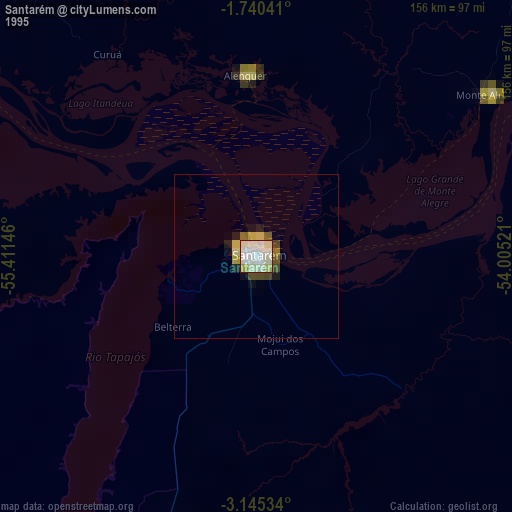
» NASA, Earths city lights 1995
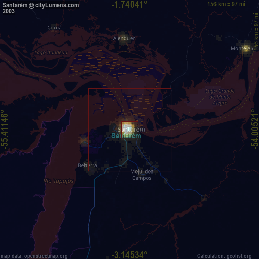
» NASA city lights 2003
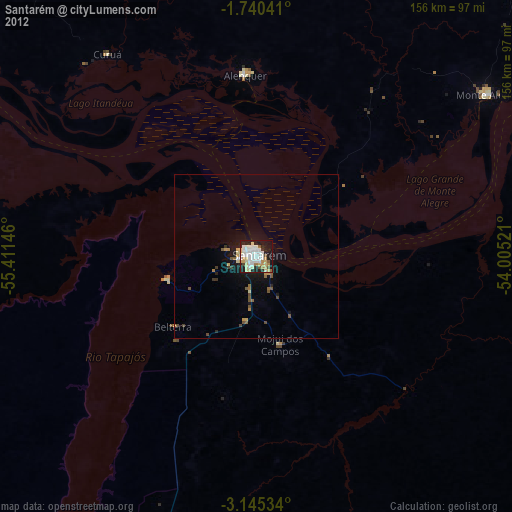
» Earth at Night: Flat Maps 2012, 2016