Nhamundá night lights from space
Night Light of Nhamundá (Amazonas) from space (Brazil) Src. Average luminocity for 10x10km area is 4.3009% and for 50x50km: 0.3345%.
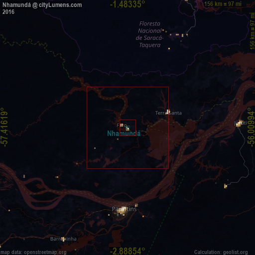
Analysis of Nhamundá night lights 2016
Square area 10x10 km:
 0%
0%90-99
0%80-89
0.87%70-79
0%60-69
0.87%50-59
0%40-49
3.25%30-39
2.81%20-29
0%10-19
0%0-9
92.21%Square area 50x50 km:
0.03%90-99
0.05%80-89
0.06%70-79
0%60-69
0.03%50-59
0%40-49
0.2%30-39
0.15%20-29
0%10-19
0%0-9
99.48%Clear (daylight) street map image can be seen on geolist.org.
Map coordinates:
1° 29' 0.1" South, 57° 24' 58.3" West
2° 11' 10" South, 56° 42' 47" West
2° 53' 18.7" South, 56° 0' 35.8" West
Some cities around Nhamundá sort by population:
• Parintins
49.2 km =30.6 mi,  182°
182°
• Oriximiná
105.1 km =65.3 mi,  63°
63°
• Óbidos
136.1 km =84.6 mi,  77°
77°
• Terra Santa
26.7 km =16.6 mi,  70°
70°
• Juruti
69.1 km =42.9 mi,  86°
86°
• Barreirinha
78.3 km =48.7 mi,  210°
210°
• Guajará
136.9 km =85.1 mi,  230°
230°
• Urucará
122.7 km =76.2 mi,  251°
251°
3393929 (p: 7,772)
Sources (retrieved 2019-11-25):
» Earth at Night: Flat Maps 2012, 2016