Governador Valadares night lights from space
Night Light of Governador Valadares (Minas Gerais) from space (Brazil) Src. Average luminocity for 10x10km area is 60.9805% and for 50x50km: 5.1167%.
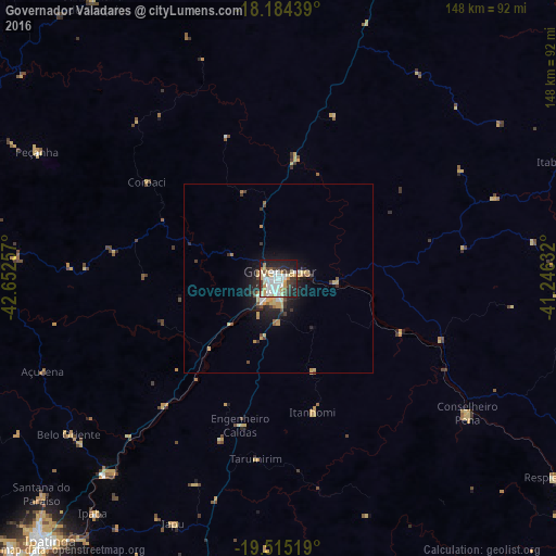

Analysis of Governador Valadares night lights 2016
Square area 10x10 km:
 14.72%
90-99
17.75%80-89
10.17%70-79
7.14%60-69
3.25%50-59
2.81%40-49
5.63%30-39
10.17%20-29
13.85%10-19
14.29%0-9
0.22%Square area 50x50 km:
0.7%90-99
0.82%80-89
0.91%70-79
0.78%60-69
0.4%50-59
0.27%40-49
0.68%30-39
0.88%20-29
1.34%10-19
3.71%0-9
89.51%Clear (daylight) street map image can be seen on geolist.org.
Map coordinates:
18° 11' 3.8" South, 42° 39' 9.3" West
18° 51' 4" South, 41° 56' 58" West
19° 30' 54.7" South, 41° 14' 46.8" West
Some cities around Governador Valadares sort by population:
• Santana do Paraíso
86.5 km =53.7 mi,  228°
228°
• Belo Oriente
69.5 km =43.2 mi, 233°
• Ipaba
79.7 km =49.5 mi,  218°
218°
• Açucena
67.4 km =41.9 mi,  248°
248°
• Inhapim
79.7 km =49.5 mi,  192°
192°
• Conselheiro Pena
61.6 km =38.3 mi,  125°
125°
• Divino das Laranjeiras
50.1 km =31.1 mi,  80°
80°
• Peçanha
72.3 km =44.9 mi,  297°
297°
3462315 (p: 250,878)
Sources (retrieved 2019-11-25):
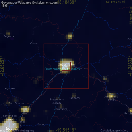
» NASA, Earths city lights 1995
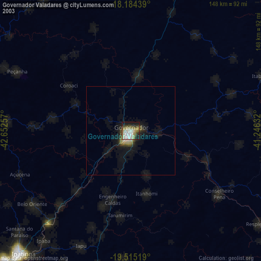
» NASA city lights 2003
» Earth at Night: Flat Maps 2012, 2016