Salgueiro night lights from space
Night Light of Salgueiro (Pernambuco) from space (Brazil) Src. Average luminocity for 10x10km area is 29.5331% and for 50x50km: 2.2535%.
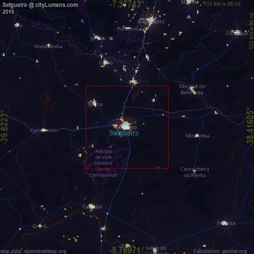

Analysis of Salgueiro night lights 2016
Square area 10x10 km:
 7.44%
7.44%90-99
6.82%80-89
3.51%70-79
1.24%60-69
1.65%50-59
1.65%40-49
2.07%30-39
3.31%20-29
4.34%10-19
35.74%0-9
32.23%Square area 50x50 km:
0.32%90-99
0.42%80-89
0.22%70-79
0.26%60-69
0.13%50-59
0.29%40-49
0.21%30-39
0.28%20-29
0.46%10-19
1.82%0-9
95.59%Clear (daylight) street map image can be seen on geolist.org.
Map coordinates:
7° 22' 38.7" South, 39° 49' 20.3" West
8° 4' 27" South, 39° 7' 9" West
8° 46' 11" South, 38° 24' 57.8" West
Some cities around Salgueiro sort by population:
• Barbalha
87.3 km =54.2 mi,  346°
346°
• Brejo Santo
66.2 km =41.1 mi,  12°
12°
• Floresta
84.3 km =52.4 mi,  134°
134°
• Cabrobó
53.2 km =33.1 mi,  203°
203°
• São José do Belmonte
46.1 km =28.6 mi,  59°
59°
• Milagres
86.7 km =53.9 mi, 12°
• Belém de São Francisco
77.4 km =48.1 mi,  167°
167°
• Parnamirim
50.6 km =31.4 mi,  267°
267°
3389860 (p: 42,152)
Sources (retrieved 2019-11-25):
» Earth at Night: Flat Maps 2012, 2016