Barbalha night lights from space
Night Light of Barbalha (Ceará) from space (Brazil) Src. Average luminocity for 10x10km area is 48.2424% and for 50x50km: 13.7682%.
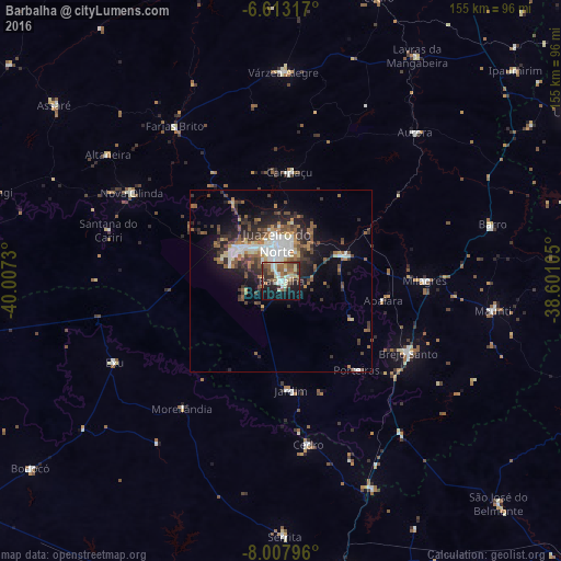

Analysis of Barbalha night lights 2016
Square area 10x10 km:
 5.63%
5.63%90-99
12.55%80-89
6.93%70-79
1.3%60-69
9.31%50-59
11.47%40-49
5.19%30-39
8.87%20-29
10.17%10-19
24.24%0-9
4.33%Square area 50x50 km:
2.1%90-99
2.39%80-89
1.16%70-79
0.87%60-69
2.27%50-59
2.5%40-49
2.29%30-39
2.91%20-29
3.98%10-19
6.7%0-9
72.83%Clear (daylight) street map image can be seen on geolist.org.
Map coordinates:
6° 36' 47.4" South, 40° 0' 26.3" West
7° 18' 40" South, 39° 18' 15" West
8° 0' 28.7" South, 38° 36' 3.8" West
Some cities around Barbalha sort by population:
• Juazeiro do Norte
11 km =6.8 mi,  353°
353°
• Crato
14.4 km =8.9 mi,  306°
306°
• Brejo Santo
40.4 km =25.1 mi,  120°
120°
• Missão Velha
19 km =11.8 mi,  68°
68°
• Caririaçu
30 km =18.6 mi,  4°
4°
• Milagres
39.6 km =24.6 mi,  90°
90°
• Farias Brito
51.2 km =31.8 mi,  325°
325°
• Exu
51.4 km =31.9 mi,  244°
244°
3406442 (p: 33,943)
Sources (retrieved 2019-11-25):
» Earth at Night: Flat Maps 2012, 2016