Recreio night lights from space
Night Light of Recreio (Minas Gerais) from space (Brazil) Src. Average luminocity for 10x10km area is 5.8144% and for 50x50km: 2.9831%.
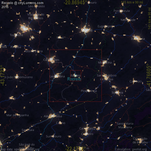
Analysis of Recreio night lights 2016
Square area 10x10 km:
 0.38%
0.38%90-99
0.95%80-89
0.38%70-79
1.33%60-69
0.76%50-59
1.14%40-49
1.14%30-39
0.76%20-29
1.33%10-19
0.95%0-9
90.91%Square area 50x50 km:
0.34%90-99
0.44%80-89
0.19%70-79
0.38%60-69
0.54%50-59
0.19%40-49
0.72%30-39
0.45%20-29
0.4%10-19
1.14%0-9
95.19%Clear (daylight) street map image can be seen on geolist.org.
Map coordinates:
20° 52' 10" South, 43° 10' 20.3" West
21° 31' 30" South, 42° 28' 9" West
22° 10' 39.4" South, 41° 45' 57.8" West
Some cities around Recreio sort by population:
• Muriaé
45.1 km =28 mi,  13°
13°
• Cataguases
28 km =17.4 mi,  302°
302°
• Leopoldina
18 km =11.2 mi,  267°
267°
• Santo Antônio de Pádua
29.9 km =18.6 mi,  93°
93°
• Miracema
30.9 km =19.2 mi,  66°
66°
• Itaocara
43.7 km =27.2 mi,  111°
111°
• Astolfo Dutra
46.9 km =29.1 mi, 299°
• Miraí
39.6 km =24.6 mi,  337°
337°
3451750 (p: 8,882)
Sources (retrieved 2019-11-25):
» Earth at Night: Flat Maps 2012, 2016