Muriaé night lights from space
Night Light of Muriaé (Minas Gerais) from space (Brazil) Src. Average luminocity for 10x10km area is 41.3571% and for 50x50km: 3.6711%.
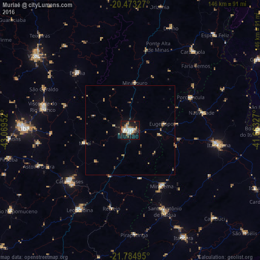
Analysis of Muriaé night lights 2016
Square area 10x10 km:
 10.71%
90-99
7.74%80-89
1.59%70-79
6.94%60-69
5.95%50-59
3.37%40-49
3.17%30-39
3.57%20-29
6.35%10-19
41.87%0-9
8.73%Square area 50x50 km:
0.49%90-99
0.39%80-89
0.31%70-79
0.74%60-69
0.52%50-59
0.38%40-49
0.49%30-39
0.41%20-29
0.66%10-19
2.7%0-9
92.91%Clear (daylight) street map image can be seen on geolist.org.
Map coordinates:
20° 28' 23.8" South, 43° 4' 10.3" West
21° 7' 50" South, 42° 21' 59" West
21° 47' 5.8" South, 41° 39' 47.8" West
Some cities around Muriaé sort by population:
• Itaperuna
50.3 km =31.3 mi,  99°
99°
• Cataguases
44.7 km =27.8 mi,  229°
229°
• Santo Antônio de Pádua
49.4 km =30.7 mi,  157°
157°
• Miracema
35.9 km =22.3 mi,  150°
150°
• Porciúncula
38.6 km =24 mi,  61°
61°
• Natividade
41.9 km =26 mi,  76°
76°
• Recreio
45.1 km =28 mi,  193°
193°
• Miraí
26.7 km =16.6 mi,  254°
254°
3456500 (p: 91,173)
Sources (retrieved 2019-11-25):
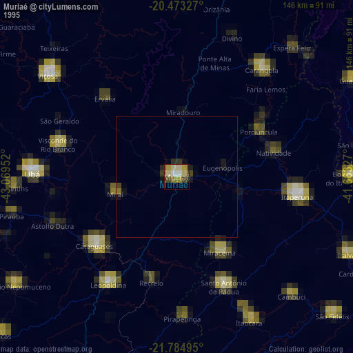
» NASA, Earths city lights 1995
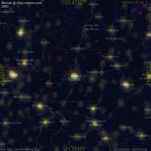
» NASA city lights 2003
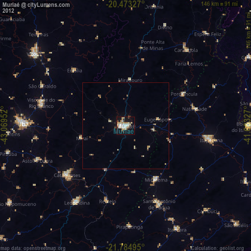
» Earth at Night: Flat Maps 2012, 2016