Quatá night lights from space
Night Light of Quatá (São Paulo) from space (Brazil) Src. Average luminocity for 10x10km area is 15.2803% and for 50x50km: 2.711%.
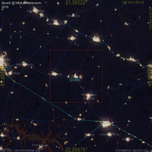
Analysis of Quatá night lights 2016
Square area 10x10 km:
 0.95%
0.95%90-99
1.33%80-89
2.08%70-79
5.49%60-69
2.08%50-59
1.52%40-49
1.7%30-39
0.76%20-29
0.76%10-19
1.14%0-9
82.2%Square area 50x50 km:
0.29%90-99
0.3%80-89
0.27%70-79
0.69%60-69
0.37%50-59
0.21%40-49
0.44%30-39
0.32%20-29
0.15%10-19
0.59%0-9
96.38%Clear (daylight) street map image can be seen on geolist.org.
Map coordinates:
21° 35' 42.8" South, 51° 24' 5.3" West
22° 14' 51" South, 50° 41' 54" West
22° 53' 48.3" South, 49° 59' 42.8" West
Some cities around Quatá sort by population:
• Assis
54.6 km =33.9 mi,  147°
147°
• Tupã
39.6 km =24.6 mi,  28°
28°
• Paraguaçu Paulista
22.3 km =13.9 mi, 145°
• Osvaldo Cruz
53.5 km =33.2 mi,  339°
339°
• Rancharia
20.1 km =12.5 mi,  275°
275°
• Martinópolis
49.9 km =31 mi, 283°
• Bastos
36.4 km =22.6 mi,  354°
354°
• Maracaí
40.5 km =25.2 mi,  175°
175°
3452167 (p: 10,370)
Sources (retrieved 2019-11-25):
» Earth at Night: Flat Maps 2012, 2016