Tupã night lights from space
Night Light of Tupã (São Paulo) from space (Brazil) Src. Average luminocity for 10x10km area is 33.5337% and for 50x50km: 3.3854%.
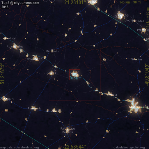

Analysis of Tupã night lights 2016
Square area 10x10 km:
 8.13%
8.13%90-99
6.15%80-89
0%70-79
8.13%60-69
3.57%50-59
0.6%40-49
5.75%30-39
1.79%20-29
3.57%10-19
40.48%0-9
21.83%Square area 50x50 km:
0.51%90-99
0.39%80-89
0.23%70-79
0.67%60-69
0.54%50-59
0.12%40-49
0.58%30-39
0.41%20-29
0.41%10-19
2.05%0-9
94.08%Clear (daylight) street map image can be seen on geolist.org.
Map coordinates:
21° 16' 51.6" South, 51° 13' 0.3" West
21° 56' 5" South, 50° 30' 49" West
22° 35' 7.6" South, 49° 48' 37.8" West
Some cities around Tupã sort by population:
• Paraguaçu Paulista
53.5 km =33.2 mi,  186°
186°
• Adamantina
64 km =39.8 mi,  295°
295°
• Osvaldo Cruz
40.7 km =25.3 mi,  292°
292°
• Rancharia
51 km =31.7 mi,  230°
230°
• Pompéia
40.2 km =25 mi,  118°
118°
• Bastos
22.8 km =14.2 mi,  273°
273°
• Lucélia
57.3 km =35.6 mi, 294°
• Quatá
39.6 km =24.6 mi,  208°
208°
3445942 (p: 62,035)
Sources (retrieved 2019-11-25):
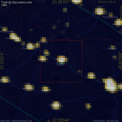
» NASA, Earths city lights 1995
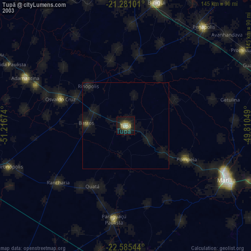
» NASA city lights 2003
» Earth at Night: Flat Maps 2012, 2016