Presidente Bernardes night lights from space
Night Light of Presidente Bernardes (São Paulo) from space (Brazil) Src. Average luminocity for 10x10km area is 8.6786% and for 50x50km: 8.4216%.
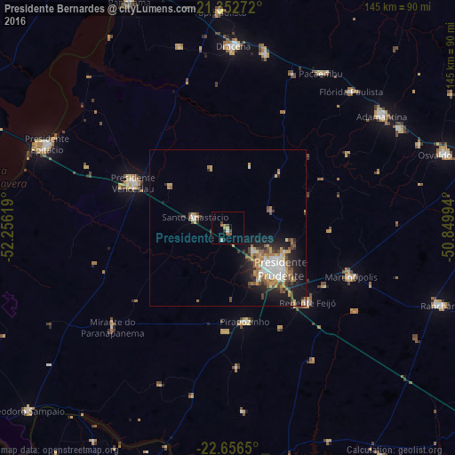
Analysis of Presidente Bernardes night lights 2016
Square area 10x10 km:
 1.19%
1.19%90-99
0.4%80-89
0.79%70-79
1.79%60-69
1.19%50-59
1.19%40-49
2.38%30-39
1.19%20-29
0.4%10-19
0.6%0-9
88.89%Square area 50x50 km:
1.33%90-99
1.34%80-89
0.75%70-79
1.37%60-69
1.27%50-59
0.88%40-49
1.59%30-39
0.98%20-29
2%10-19
4.95%0-9
83.54%Clear (daylight) street map image can be seen on geolist.org.
Map coordinates:
21° 21' 9.8" South, 52° 15' 22.3" West
22° 0' 22" South, 51° 33' 11" West
22° 39' 23.4" South, 50° 50' 59.8" West
Some cities around Presidente Bernardes sort by population:
• Pirapozinho
30.4 km =18.9 mi,  169°
169°
• Álvares Machado
11.7 km =7.3 mi,  134°
134°
• Martinópolis
42.3 km =26.3 mi,  111°
111°
• Santo Anastácio
19.6 km =12.2 mi,  342°
342°
• Regente Feijó
35.2 km =21.9 mi, 132°
• Junqueirópolis
56 km =34.8 mi,  12°
12°
• Pacaembu
57.9 km =36 mi,  31°
31°
• Mirante do Paranapanema
48.3 km =30 mi,  228°
228°
3452335 (p: 12,953)
Sources (retrieved 2019-11-25):
» Earth at Night: Flat Maps 2012, 2016