Regente Feijó night lights from space
Night Light of Regente Feijó (São Paulo) from space (Brazil) Src. Average luminocity for 10x10km area is 18.4754% and for 50x50km: 9.4747%.
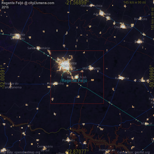
Analysis of Regente Feijó night lights 2016
Square area 10x10 km:
 0.95%
0.95%90-99
2.27%80-89
1.7%70-79
4.36%60-69
2.65%50-59
1.33%40-49
5.11%30-39
0.95%20-29
0.76%10-19
19.51%0-9
60.42%Square area 50x50 km:
1.36%90-99
1.47%80-89
0.73%70-79
1.75%60-69
1.45%50-59
0.94%40-49
1.84%30-39
1.05%20-29
1.87%10-19
5.14%0-9
82.41%Clear (daylight) street map image can be seen on geolist.org.
Map coordinates:
21° 34' 8.4" South, 52° 0' 21.3" West
22° 13' 17" South, 51° 18' 10" West
22° 52' 14.8" South, 50° 35' 58.8" West
Some cities around Regente Feijó sort by population:
• Presidente Prudente
13.9 km =8.6 mi,  320°
320°
• Rancharia
42.2 km =26.2 mi,  91°
91°
• Pirapozinho
21.2 km =13.2 mi,  253°
253°
• Álvares Machado
23.5 km =14.6 mi,  312°
312°
• Martinópolis
16 km =9.9 mi,  58°
58°
• Santo Anastácio
53.1 km =33 mi, 323°
• Presidente Bernardes
35.2 km =21.9 mi, 312°
• Porecatu
59.9 km =37.2 mi,  187°
187°
3451709 (p: 17,218)
Sources (retrieved 2019-11-25):
» Earth at Night: Flat Maps 2012, 2016