Pacaembu night lights from space
Night Light of Pacaembu (São Paulo) from space (Brazil) Src. Average luminocity for 10x10km area is 8.214% and for 50x50km: 2.8893%.
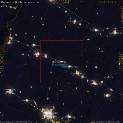
Analysis of Pacaembu night lights 2016
Square area 10x10 km:
 1.14%
1.14%90-99
0.38%80-89
1.52%70-79
0.76%60-69
2.27%50-59
0.76%40-49
1.52%30-39
0.76%20-29
1.14%10-19
1.14%0-9
88.64%Square area 50x50 km:
0.36%90-99
0.31%80-89
0.17%70-79
0.35%60-69
0.69%50-59
0.28%40-49
0.62%30-39
0.22%20-29
0.22%10-19
1.68%0-9
95.09%Clear (daylight) street map image can be seen on geolist.org.
Map coordinates:
20° 54' 24.6" South, 51° 57' 49.3" West
21° 33' 44" South, 51° 15' 38" West
22° 12' 52.7" South, 50° 33' 26.8" West
Some cities around Pacaembu sort by population:
• Adamantina
23.8 km =14.8 mi,  125°
125°
• Osvaldo Cruz
47.3 km =29.4 mi,  123°
123°
• Mirandopólis
50.4 km =31.3 mi,  19°
19°
• Santo Anastácio
47.4 km =29.5 mi,  229°
229°
• Lucélia
30.5 km =19 mi, 125°
• Junqueirópolis
18.7 km =11.6 mi,  286°
286°
• Tupi Paulista
37.9 km =23.5 mi,  302°
302°
• Paulista Flórida
7.5 km =4.7 mi, 123°
3455643 (p: 10,101)
Sources (retrieved 2019-11-25):
» Earth at Night: Flat Maps 2012, 2016