Sete Lagoas night lights from space
Night Light of Sete Lagoas (Minas Gerais) from space (Brazil) Src. Average luminocity for 10x10km area is 73.343% and for 50x50km: 13.5484%.
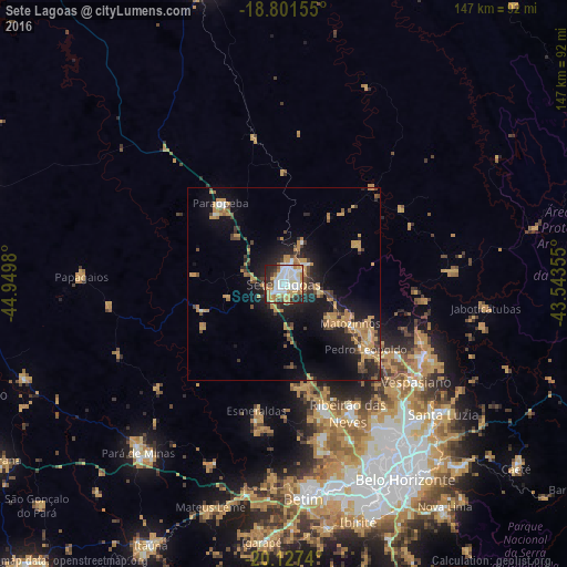


Analysis of Sete Lagoas night lights 2016
Square area 10x10 km:
 20.66%
90-99
23.14%80-89
6.4%70-79
11.16%60-69
11.36%50-59
2.69%40-49
4.55%30-39
5.79%20-29
13.64%10-19
0.62%0-9
0%Square area 50x50 km:
1.18%90-99
1.36%80-89
0.97%70-79
4.11%60-69
2.33%50-59
0.97%40-49
2.07%30-39
1.8%20-29
4.09%10-19
9.67%0-9
71.46%Clear (daylight) street map image can be seen on geolist.org.
Map coordinates:
18° 48' 5.6" South, 44° 56' 59.3" West
19° 27' 57" South, 44° 14' 48" West
20° 7' 38.6" South, 43° 32' 36.8" West
Some cities around Sete Lagoas sort by population:
• Ribeirão das Neves
37.4 km =23.2 mi,  153°
153°
• Santa Luzia
53.4 km =33.2 mi,  129°
129°
• Esmeraldas
33.7 km =20.9 mi,  192°
192°
• Vespasiano
42.2 km =26.2 mi, 126°
• Pedro Leopoldo
27.2 km =16.9 mi, 128°
• Lagoa Santa
40.6 km =25.2 mi,  116°
116°
• Matozinhos
20.1 km =12.5 mi, 120°
• Papagaios
52.6 km =32.7 mi,  272°
272°
3447624 (p: 201,334)
Sources (retrieved 2019-11-25):
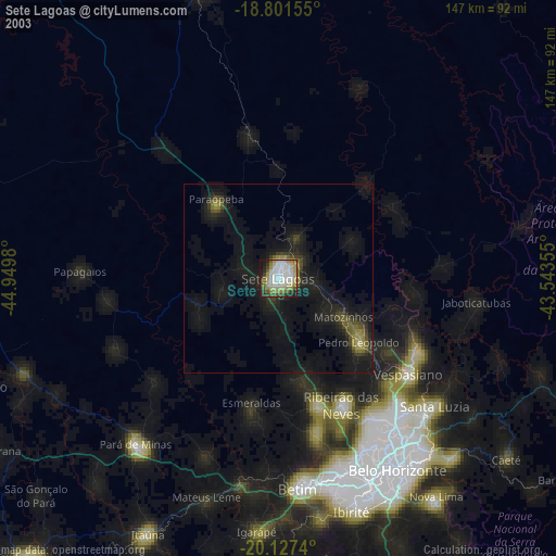
» NASA, Earths city lights 1995
» NASA city lights 2003
» Earth at Night: Flat Maps 2012, 2016