Paulo Afonso night lights from space
Night Light of Paulo Afonso (Bahia) from space (Brazil) Src. Average luminocity for 10x10km area is 62.8528% and for 50x50km: 7.6014%.
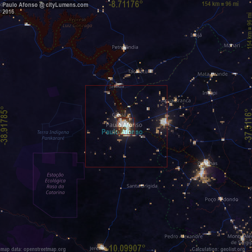
Analysis of Paulo Afonso night lights 2016
Square area 10x10 km:
 19.7%
19.7%90-99
17.97%80-89
2.38%70-79
4.33%60-69
6.93%50-59
7.14%40-49
7.36%30-39
9.74%20-29
17.75%10-19
6.71%0-9
0%Square area 50x50 km:
1.14%90-99
1.36%80-89
0.38%70-79
0.47%60-69
0.91%50-59
1.33%40-49
1.39%30-39
1.31%20-29
1.84%10-19
5.9%0-9
83.98%Clear (daylight) street map image can be seen on geolist.org.
Map coordinates:
8° 42' 42.3" South, 38° 55' 4.3" West
9° 24' 22" South, 38° 12' 53" West
10° 5' 56.7" South, 37° 30' 41.8" West
Some cities around Paulo Afonso sort by population:
• Delmiro Gouveia
23.7 km =14.7 mi,  85°
85°
• Jatobá
25.5 km =15.8 mi,  346°
346°
• Jeremoabo
79.9 km =49.6 mi,  201°
201°
• São José da Tapera
93 km =57.8 mi,  100°
100°
• Pão de Açúcar
93.4 km =58 mi,  114°
114°
• Canindé de São Francisco
54.5 km =33.9 mi,  121°
121°
• Inhapi
55.1 km =34.2 mi,  68°
68°
• Água Branca
34.6 km =21.5 mi,  62°
62°
3392734 (p: 85,350)
Sources (retrieved 2019-11-25):
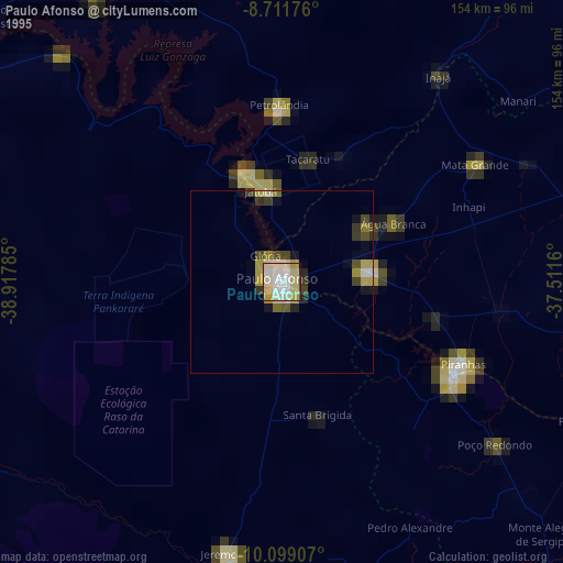
» NASA, Earths city lights 1995
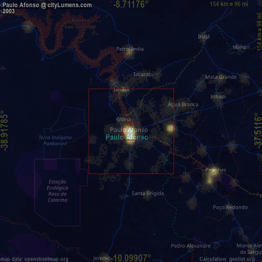
» NASA city lights 2003
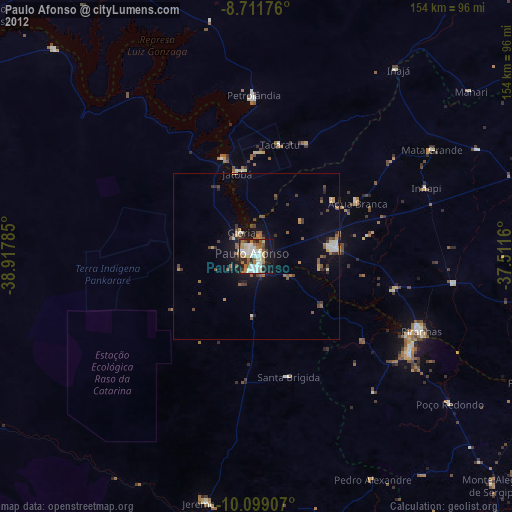
» Earth at Night: Flat Maps 2012, 2016