Jeremoabo night lights from space
Night Light of Jeremoabo (Bahia) from space (Brazil) Src. Average luminocity for 10x10km area is 0.0041% and for 50x50km: 0.7397%.
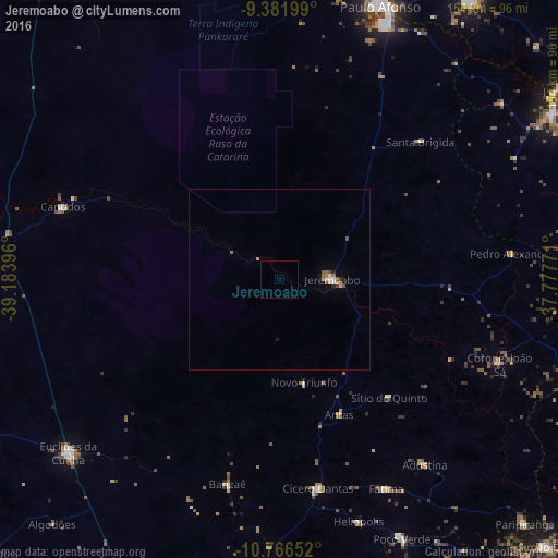
Analysis of Jeremoabo night lights 2016
Square area 10x10 km:
 0%
0%90-99
0%80-89
0%70-79
0%60-69
0%50-59
0%40-49
0%30-39
0%20-29
0%10-19
0%0-9
100%Square area 50x50 km:
0.07%90-99
0.1%80-89
0.04%70-79
0.09%60-69
0.15%50-59
0.2%40-49
0.08%30-39
0.03%20-29
0.1%10-19
0.07%0-9
99.06%Clear (daylight) street map image can be seen on geolist.org.
Map coordinates:
9° 22' 55.2" South, 39° 11' 2.3" West
10° 4' 30" South, 38° 28' 51" West
10° 45' 59.5" South, 37° 46' 39.8" West
Some cities around Jeremoabo sort by population:
• Paulo Afonso
79.9 km =49.6 mi,  21°
21°
• Delmiro Gouveia
92.8 km =57.7 mi,  34°
34°
• Euclides da Cunha
75.8 km =47.1 mi,  230°
230°
• Ribeira do Pombal
84.7 km =52.6 mi,  184°
184°
• Cícero Dantas
59.3 km =36.8 mi,  169°
169°
• Poço Verde
77.6 km =48.2 mi,  155°
155°
• Canindé de São Francisco
88.7 km =55.1 mi,  58°
58°
• Carira
91 km =56.5 mi,  110°
110°
3459922 (p: 16,642)
Sources (retrieved 2019-11-25):
» Earth at Night: Flat Maps 2012, 2016