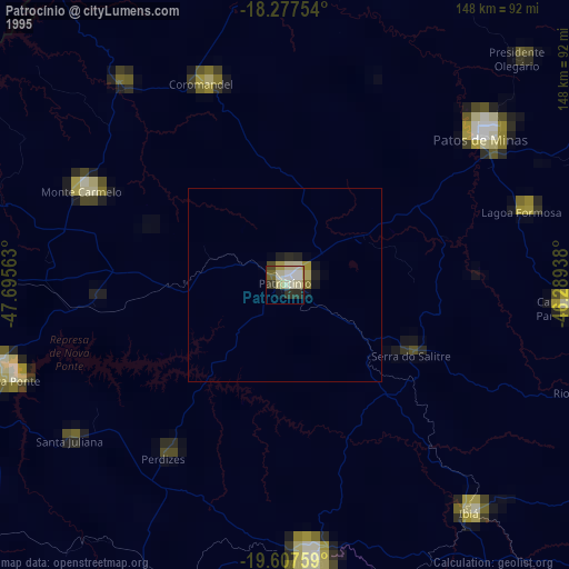
Patrocínio night lights from space
Night Light of Patrocínio (Minas Gerais) from space (Brazil) Src. Average luminocity for 10x10km area is 42.0693% and for 50x50km: 2.1748%.
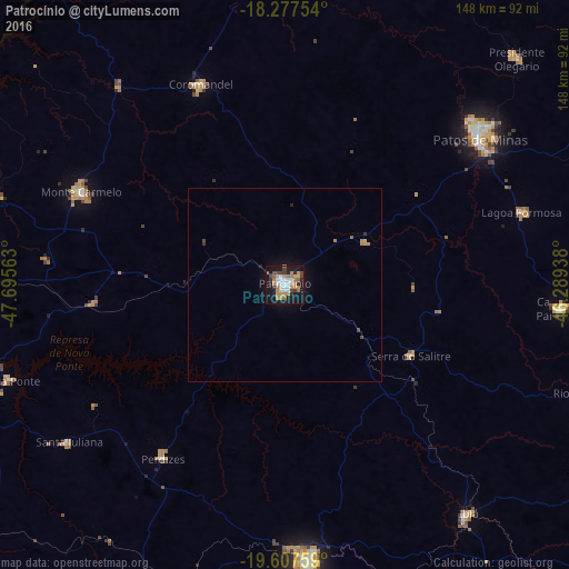
Analysis of Patrocínio night lights 2016
Square area 10x10 km:
 8.23%
8.23%90-99
6.06%80-89
2.16%70-79
10.39%60-69
8.66%50-59
3.9%40-49
5.41%30-39
4.98%20-29
4.11%10-19
38.96%0-9
7.14%Square area 50x50 km:
0.31%90-99
0.23%80-89
0.11%70-79
0.52%60-69
0.38%50-59
0.18%40-49
0.3%30-39
0.24%20-29
0.24%10-19
2.04%0-9
95.44%Clear (daylight) street map image can be seen on geolist.org.
Map coordinates:
18° 16' 39.1" South, 47° 41' 44.3" West
18° 56' 38" South, 46° 59' 33" West
19° 36' 27.3" South, 46° 17' 21.8" West
Some cities around Patrocínio sort by population:
• Patos de Minas
64.4 km =40 mi,  50°
50°
• Araxá
72.4 km =45 mi,  175°
175°
• Monte Carmelo
58.6 km =36.4 mi,  294°
294°
• Carmo do Paranaíba
71.4 km =44.4 mi,  95°
95°
• Coromandel
56.7 km =35.2 mi,  337°
337°
• Ibiá
76.2 km =47.3 mi,  141°
141°
• Presidente Olegário
84.2 km =52.3 mi, 45°
• Lagoa Formosa
64.2 km =39.9 mi,  73°
73°
3454763 (p: 71,963)
Sources (retrieved 2019-11-25):
» NASA, Earths city lights 1995
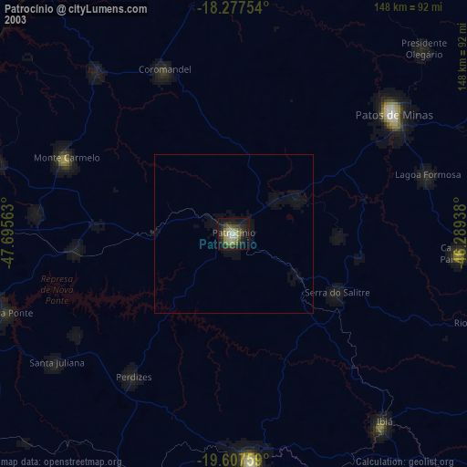
» NASA city lights 2003
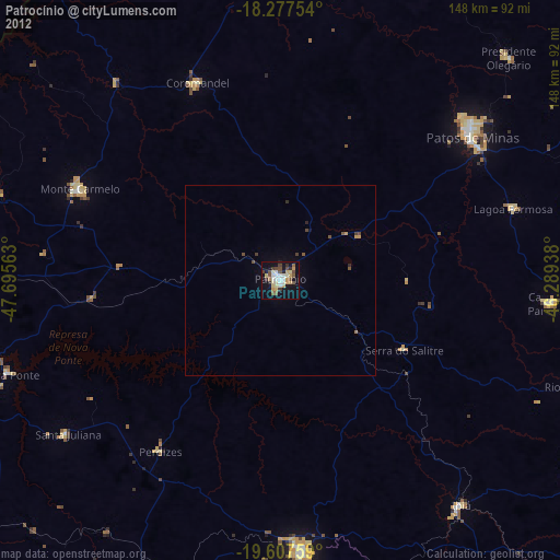
» Earth at Night: Flat Maps 2012, 2016