Itajubá night lights from space
Night Light of Itajubá (Minas Gerais) from space (Brazil) Src. Average luminocity for 10x10km area is 43.4489% and for 50x50km: 3.4536%.
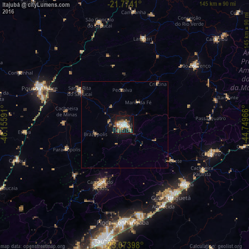
Analysis of Itajubá night lights 2016
Square area 10x10 km:
 6.63%
6.63%90-99
8.52%80-89
6.25%70-79
7.58%60-69
3.6%50-59
7.77%40-49
3.98%30-39
5.87%20-29
9.09%10-19
34.66%0-9
6.06%Square area 50x50 km:
0.3%90-99
0.38%80-89
0.43%70-79
0.66%60-69
0.45%50-59
0.5%40-49
0.38%30-39
0.65%20-29
0.65%10-19
2.88%0-9
92.71%Clear (daylight) street map image can be seen on geolist.org.
Map coordinates:
21° 46' 26.8" South, 46° 9' 21.3" West
22° 25' 32" South, 45° 27' 10" West
23° 4' 26.3" South, 44° 44' 58.8" West
Some cities around Itajubá sort by population:
• Guaratinguetá
51 km =31.7 mi,  148°
148°
• Lorena
47.8 km =29.7 mi,  135°
135°
• Campos do Jordão
37.7 km =23.4 mi,  202°
202°
• Santa Rita do Sapucaí
32.2 km =20 mi,  306°
306°
• Lambari
51.1 km =31.8 mi,  11°
11°
• Piquete
35.3 km =21.9 mi,  126°
126°
• Paraisópolis
36.5 km =22.7 mi,  246°
246°
• Passa Quatro
50.1 km =31.1 mi,  85°
85°
3460834 (p: 81,870)
Sources (retrieved 2019-11-25):
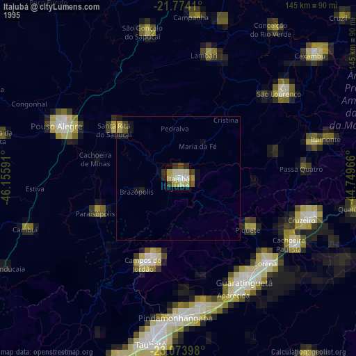
» NASA, Earths city lights 1995
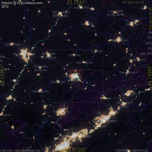
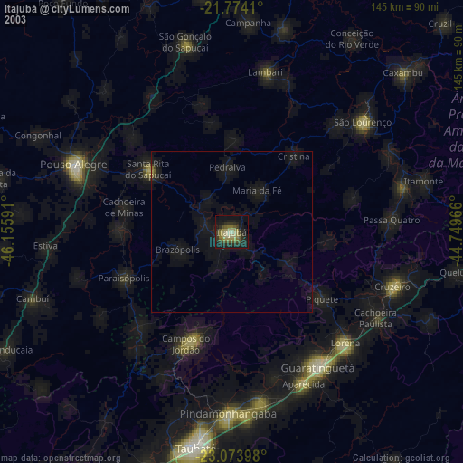
» NASA city lights 2003
» Earth at Night: Flat Maps 2012, 2016