Juiz de Fora night lights from space
Night Light of Juiz de Fora (Minas Gerais) from space (Brazil) Src. Average luminocity for 10x10km area is 76.7103% and for 50x50km: 9.085%.
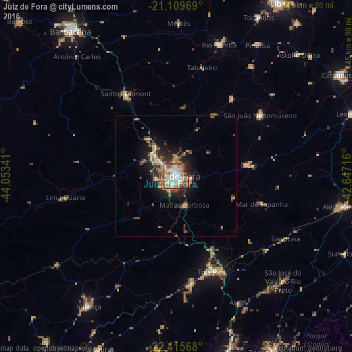
Analysis of Juiz de Fora night lights 2016
Square area 10x10 km:
 21.03%
90-99
22.82%80-89
6.15%70-79
12.1%60-69
17.46%50-59
4.96%40-49
6.55%30-39
3.17%20-29
5.16%10-19
0.6%0-9
0%Square area 50x50 km:
1.1%90-99
1.34%80-89
0.63%70-79
1.33%60-69
2.34%50-59
1.02%40-49
1.37%30-39
1.59%20-29
2.64%10-19
5.39%0-9
81.26%Clear (daylight) street map image can be seen on geolist.org.
Map coordinates:
21° 6' 34.9" South, 44° 3' 12.3" West
21° 45' 51" South, 43° 21' 1" West
22° 24' 56.4" South, 42° 38' 49.8" West
Some cities around Juiz de Fora sort by population:
• Três Rios
41.8 km =26 mi,  159°
159°
• Santos Dumont
40.1 km =24.9 mi,  328°
328°
• Paraíba do Sul
44.2 km =27.5 mi,  172°
172°
• São João Nepomuceno
43.1 km =26.8 mi,  54°
54°
• Bicas
30.3 km =18.8 mi,  81°
81°
• Matias Barbosa
12.1 km =7.5 mi, 164°
• Mar de Espanha
37 km =23 mi,  108°
108°
• Rio Novo
39.5 km =24.5 mi,  35°
35°
3459505 (p: 470,193)
Sources (retrieved 2019-11-25):
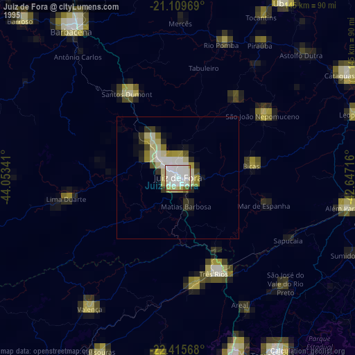
» NASA, Earths city lights 1995
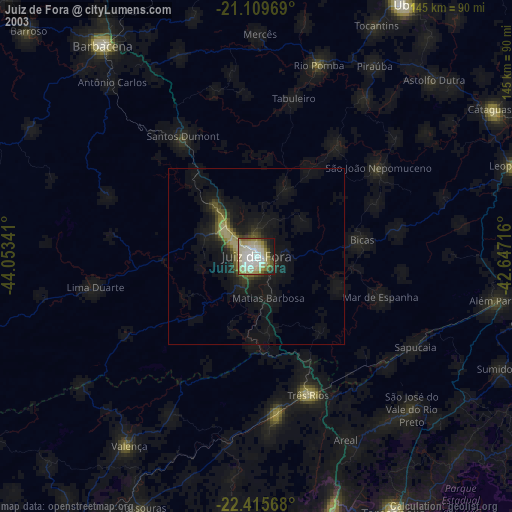
» NASA city lights 2003
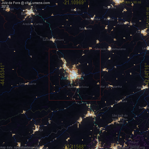
» Earth at Night: Flat Maps 2012, 2016