Paraíba do Sul night lights from space
Night Light of Paraíba do Sul (Rio de Janeiro) from space (Brazil) Src. Average luminocity for 10x10km area is 21.6329% and for 50x50km: 5.3685%.
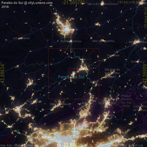
Analysis of Paraíba do Sul night lights 2016
Square area 10x10 km:
 0.6%
0.6%90-99
0.99%80-89
1.79%70-79
5.75%60-69
7.34%50-59
1.79%40-49
3.97%30-39
0.4%20-29
3.17%10-19
26.79%0-9
47.42%Square area 50x50 km:
0.13%90-99
0.27%80-89
0.48%70-79
1.04%60-69
1.33%50-59
0.67%40-49
0.89%30-39
1.27%20-29
1.08%10-19
4.49%0-9
88.33%Clear (daylight) street map image can be seen on geolist.org.
Map coordinates:
21° 30' 20.8" South, 43° 59' 46.8" West
22° 9' 30.5" South, 43° 17' 35.6" West
22° 48' 29.3" South, 42° 35' 24.3" West
Some cities around Paraíba do Sul sort by population:
• Petrópolis
40.3 km =25 mi,  162°
162°
• Três Rios
9.8 km =6.1 mi,  61°
61°
• Valença
43 km =26.7 mi,  256°
256°
• Miguel Pereira
37.5 km =23.3 mi,  208°
208°
• Paty do Alferes
32.7 km =20.3 mi,  203°
203°
• Sapucaia
43.1 km =26.8 mi,  65°
65°
• Matias Barbosa
32.3 km =20.1 mi,  355°
355°
• Areal
20.9 km =13 mi,  112°
112°
3455141 (p: 35,517)
Sources (retrieved 2019-11-25):
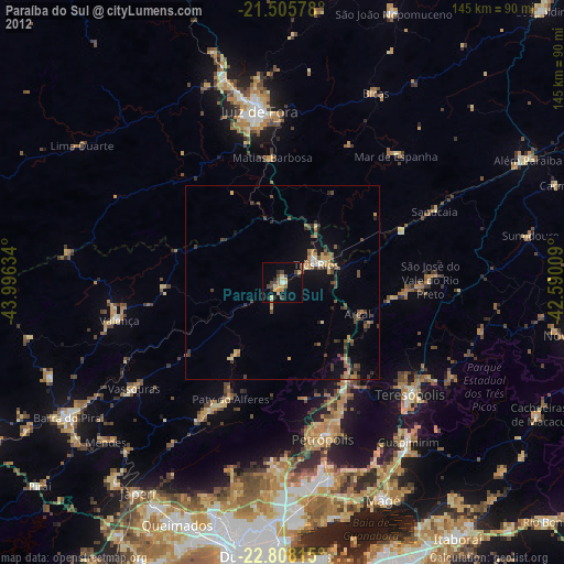
» Earth at Night: Flat Maps 2012, 2016