Bicas night lights from space
Night Light of Bicas (Minas Gerais) from space (Brazil) Src. Average luminocity for 10x10km area is 7.5246% and for 50x50km: 2.0789%.
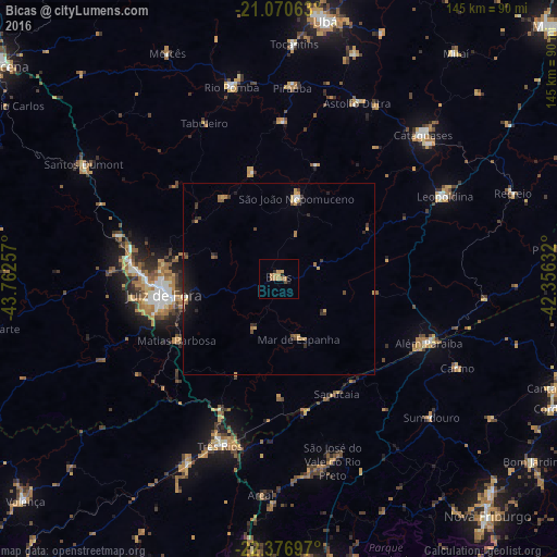
Analysis of Bicas night lights 2016
Square area 10x10 km:
 0%
0%90-99
0%80-89
1.14%70-79
3.03%60-69
3.03%50-59
0.38%40-49
0.76%30-39
0%20-29
1.52%10-19
0.76%0-9
89.39%Square area 50x50 km:
0.06%90-99
0.09%80-89
0.24%70-79
0.5%60-69
0.45%50-59
0.24%40-49
0.22%30-39
0.42%20-29
0.64%10-19
0.97%0-9
96.17%Clear (daylight) street map image can be seen on geolist.org.
Map coordinates:
21° 4' 14.3" South, 43° 45' 45.3" West
21° 43' 31" South, 43° 3' 34" West
22° 22' 37.1" South, 42° 21' 22.8" West
Some cities around Bicas sort by population:
• Juiz de Fora
30.3 km =18.8 mi,  261°
261°
• Três Rios
46.2 km =28.7 mi,  199°
199°
• Além Paraíba
40.9 km =25.4 mi,  116°
116°
• São João Nepomuceno
21.2 km =13.2 mi,  13°
13°
• Sapucaia
33.5 km =20.8 mi,  153°
153°
• Matias Barbosa
31.2 km =19.4 mi,  239°
239°
• Mar de Espanha
16.6 km =10.3 mi,  161°
161°
• Rio Novo
28.4 km =17.6 mi,  346°
346°
3470025 (p: 12,683)
Sources (retrieved 2019-11-25):
» Earth at Night: Flat Maps 2012, 2016