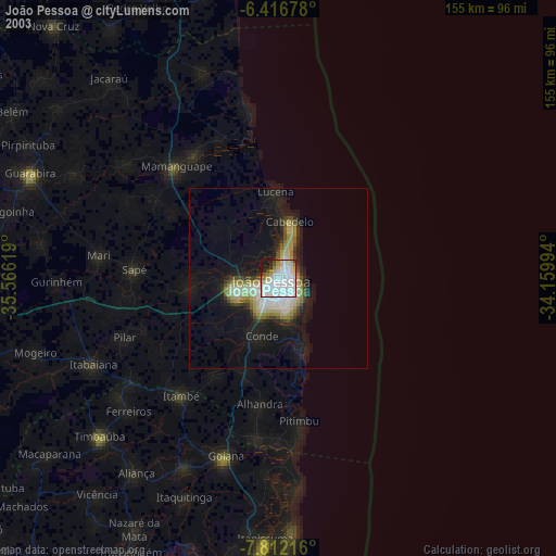
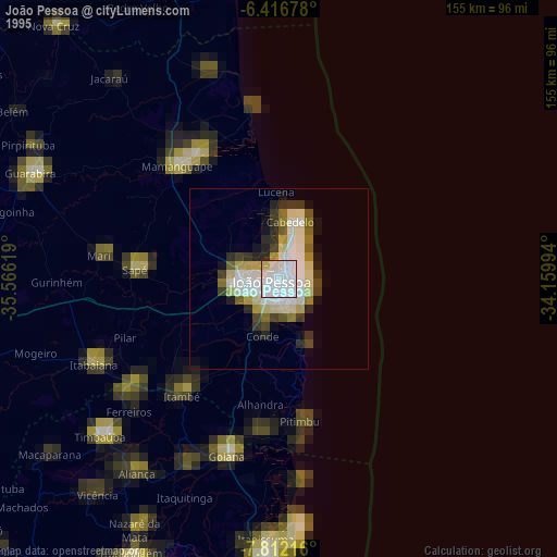
João Pessoa night lights from space
Night Light of João Pessoa (Paraíba) from space (Brazil) Src. Average luminocity for 10x10km area is 86.6407% and for 50x50km: 20.961%.
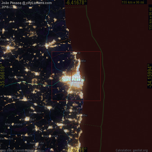
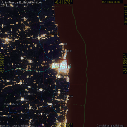
Analysis of João Pessoa night lights 2016
Square area 10x10 km:
 40.04%
90-99
27.71%80-89
8.01%70-79
0.65%60-69
7.14%50-59
6.28%40-49
7.14%30-39
1.95%20-29
1.08%10-19
0%0-9
0%Square area 50x50 km:
3.88%90-99
4.14%80-89
3.6%70-79
1.5%60-69
2.25%50-59
2.8%40-49
3.26%30-39
2.92%20-29
4.74%10-19
10.7%0-9
60.21%Clear (daylight) street map image can be seen on geolist.org.
Map coordinates:
6° 25' 0.4" South, 35° 33' 58.3" West
7° 6' 54" South, 34° 51' 47" West
7° 48' 43.8" South, 34° 9' 35.8" West
Some cities around João Pessoa sort by population:
• Santa Rita
12.7 km =7.9 mi,  270°
270°
• Bayeux
7.7 km =4.8 mi,  261°
261°
• Cabedelo
15.2 km =9.4 mi,  12°
12°
• Conde
16.8 km =10.4 mi,  196°
196°
• Rio Tinto
42.2 km =26.2 mi,  325°
325°
• Alhandra
36.4 km =22.6 mi,  188°
188°
• Pitimbu
40 km =24.9 mi,  171°
171°
• Cruz do Espírito Santo
24.8 km =15.4 mi, 263°
3397277 (p: 650,883)
Sources (retrieved 2019-11-25):
» NASA, Earths city lights 1995
» NASA city lights 2003
» Earth at Night: Flat Maps 2012, 2016