Cabedelo night lights from space
Night Light of Cabedelo (Paraíba) from space (Brazil) Src. Average luminocity for 10x10km area is 31.2316% and for 50x50km: 16.1835%.
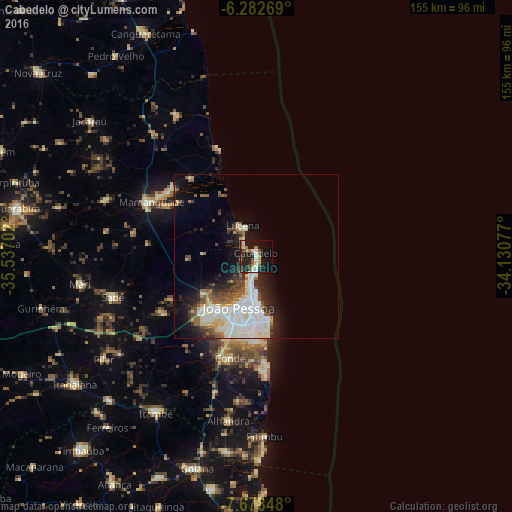
Analysis of Cabedelo night lights 2016
Square area 10x10 km:
 3.46%
3.46%90-99
3.46%80-89
5.41%70-79
1.73%60-69
6.06%50-59
3.68%40-49
6.28%30-39
3.68%20-29
9.96%10-19
35.28%0-9
21%Square area 50x50 km:
3.74%90-99
3.9%80-89
2.47%70-79
0.61%60-69
1.51%50-59
1.96%40-49
2.08%30-39
1.63%20-29
3.33%10-19
7.44%0-9
71.34%Clear (daylight) street map image can be seen on geolist.org.
Map coordinates:
6° 16' 57.7" South, 35° 32' 13.3" West
6° 58' 52" South, 34° 50' 2" West
7° 40' 42.5" South, 34° 7' 50.8" West
Some cities around Cabedelo sort by population:
• João Pessoa
15.2 km =9.4 mi,  192°
192°
• Santa Rita
21.7 km =13.5 mi,  227°
227°
• Bayeux
19.3 km =12 mi,  214°
214°
• Mamanguape
35.9 km =22.3 mi,  296°
296°
• Conde
32 km =19.9 mi, 194°
• Rio Tinto
33.7 km =20.9 mi,  306°
306°
• Alhandra
51.6 km =32.1 mi, 189°
• Cruz do Espírito Santo
33 km =20.5 mi,  237°
237°
3404558 (p: 54,839)
Sources (retrieved 2019-11-25):
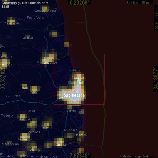
» NASA, Earths city lights 1995
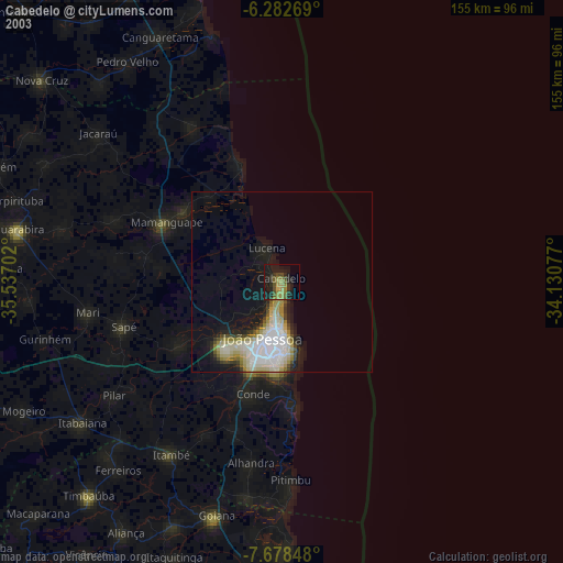
» NASA city lights 2003
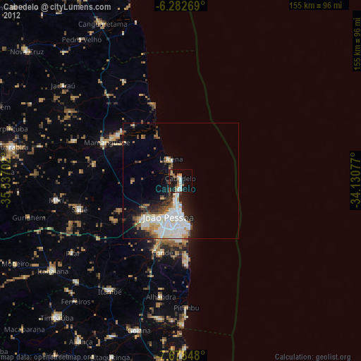
» Earth at Night: Flat Maps 2012, 2016