Trindade night lights from space
Night Light of Trindade (Pernambuco) from space (Brazil) Src. Average luminocity for 10x10km area is 21.4649% and for 50x50km: 3.7004%.
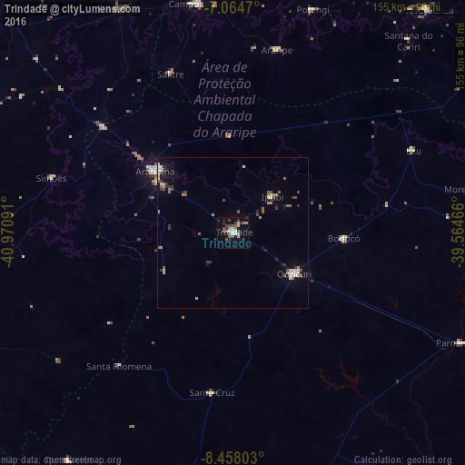
Analysis of Trindade night lights 2016
Square area 10x10 km:
 1.45%
1.45%90-99
2.69%80-89
1.86%70-79
3.93%60-69
2.48%50-59
6.4%40-49
2.48%30-39
4.34%20-29
3.93%10-19
10.54%0-9
59.92%Square area 50x50 km:
0.29%90-99
0.58%80-89
0.29%70-79
0.49%60-69
0.45%50-59
0.71%40-49
0.55%30-39
0.63%20-29
0.55%10-19
1.72%0-9
93.75%Clear (daylight) street map image can be seen on geolist.org.
Map coordinates:
7° 3' 52.9" South, 40° 58' 15.3" West
7° 45' 43" South, 40° 16' 4" West
8° 27' 28.9" South, 39° 33' 52.8" West
Some cities around Trindade sort by population:
• Araripina
32.7 km =20.3 mi,  309°
309°
• Ouricuri
24.5 km =15.2 mi,  123°
123°
• Campos Sales
77.4 km =48.1 mi,  351°
351°
• Ipueiras
83.5 km =51.9 mi, 346°
• Ipubi
17.9 km =11.1 mi,  46°
46°
• Araripe
62.7 km =39 mi,  13°
13°
• Exu
66 km =41 mi,  65°
65°
• Parnamirim
84.3 km =52.4 mi, 115°
3386042 (p: 19,313)
Sources (retrieved 2019-11-25):
» Earth at Night: Flat Maps 2012, 2016